This week, we would like to take the opportunity to showcase other fantastic blogs from our Partners and elsewhere. Revitalising Redesdale is a Landscape Partnership and it is because of the support, guidance and investments made by our Partners that we are able to deliver such a wide variety of projects for Redesdale.
Blogs are an informal way to find out about an organisation, its raison d’être and its values, which is why we created My Revitalising Redesdale. What better way to find out about the Partners that make up Revitalising Redesdale Landscape Partnership?
The Natural England blog covers a wide range of environmental topics and is a great place to learn about its pioneering work helping to protect England’s nature and landscapes for people to enjoy. From other landscape-scale ecological improvement projects like the North Devon Landscape Pioneer to researching how we are connecting with nature during the coronavirus pandemic, it is a great place to get up to speed with what is happening all over England.
Over the past few months, many of us have found a new appreciation for natural and outdoor spaces. Part of the reason for this is how much better we feel for spending time in them. Northumberland Wildlife Trust’s blog has featured a number of recent posts about the very real mental and physical health benefits we get from spending time in the natural world.
Similarly, Northumberland National Park’s blog spotlights how local businesses are adapting to the pandemic and…velvet sausages (you’ll just have to trust us on this one). You can also take a virtual tour of the Park!
Here are a few of our other favourites from Partners and elsewhere:
- It isn’t in Redesdale but for stunning videos and high drama, the Kielder Ospreys are hard to beat!
- For distinctly lower drama, at least in terms of elevation, Forestry England’s post about beavers returning to England’s forests is well worth a read.
- Wild Intrigue’s Journal is home to beautiful photography and some great Redesdale-focused wildlife stories. The recent post on moth trapping is a knockout!
- Finally, the Battlefield Trust have recently started a YouTube channel, with their Five Minute Battles series sure to be a home-schooling win.
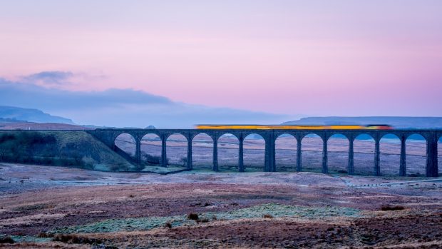
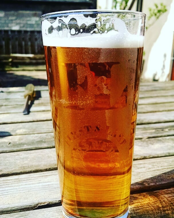
The title photo is of the viaduct at Ribble Head, copyright Natural England.
It may not feel like mid-June but summer is fast approaching and it is a great time to be out in the natural world! The birds are singing, wildflowers blooming, and lambs are putting on some timber.
This week we are handing over to Billy Bell, the famous Redesdale poet, to celebrate natural Redesdale and, perhaps, inspire you to write a poem about nature near you. As part of The Wildlife Trust’s 30 Days Wild challenge or simply because it is a wonderful way to engage with nature, why not write a poem about somewhere in Redesdale and send it to us. We would love to hear what you have to say!
From ‘Amid the Hills of Redesdale’ by William ‘Billy’ Bell
Now Phoebus with his kindly beams
Smiles sweet on woodland, fields and streams
Where happy songsters chant their themes
Amid the hills of Redesdale
Now with radiant stately mein
Summer spreads her mantle green
Where the new shorn flocks are seen
Amid the hills of Redesdale
Where the many coloured flowers
Sparkling with the dewy showers
Lighten up the fragrant bowers
Amid the hills of Redesdale
Leafy woods and ferny fells
Time worn deep and rocky dells
Clear cold bubbling crystal wells
Amid the hills of Redesdale
Where the heath bedecks the wold
Where the sunsets sink in gold
O’er the mountains grim and old
Amid the hills of Redesale
Where the pricker once did ride
Trusty broad sword by his side
Moon and stars his only guide
Amid the hills of Redesdale
Where the hut and sheltering peel
Oft the touch of fire did feel
When the Scotsmen came to steal
Amid the hills of Redesdale
Where the din of battle brayed
Where drank deep the flashing blade
Deeds of valour were displayed
Amid the hills of Redesdale
But these times have changed today
Blessed peace now holds her sway
May she reign for ay and ay
Amid the hills of Redesdale
If you haven’t already discovered it, Northumberland National Park’s collaboration with Simon Armitage – Poems in the Air – is a fantastic example of how poetry exists within the landscape. Where does poetry exist in Redesdale for you? Send us your poems about a place of natural beauty or evocative of the valley’s colourful history.
If you are looking for inspiration, you might find poetry in the ripples of wind through a wildflower meadow?
Even if poetry is not your thing, look out for wildflowers in your local area, especially the not so familiar ones, such as wood cranesbill, sneezewort, globe flower and pignut. How many types can you spot? Don’t worry if you’re not an expert, snap a photo and add it to the inaturalist app and members of the recording community can help to identify it! You can also use Plantlife’s Spotter Sheets to get an idea of what to look out for each month.
Our Reflowering Redesdale project is all about increasing the wildflower diversity and connecting networks for pollinators, in hay meadows, village green-spaces, along road verges or in certain lay-by parking spots. If you would like to get involved in this project once we are able to work outside again, please get in touch with the Team.
Please remember to follow the UK Government’s guidance on enjoying time outdoors responsibly and be considerate of local communities: www.gov.uk/coronavirus
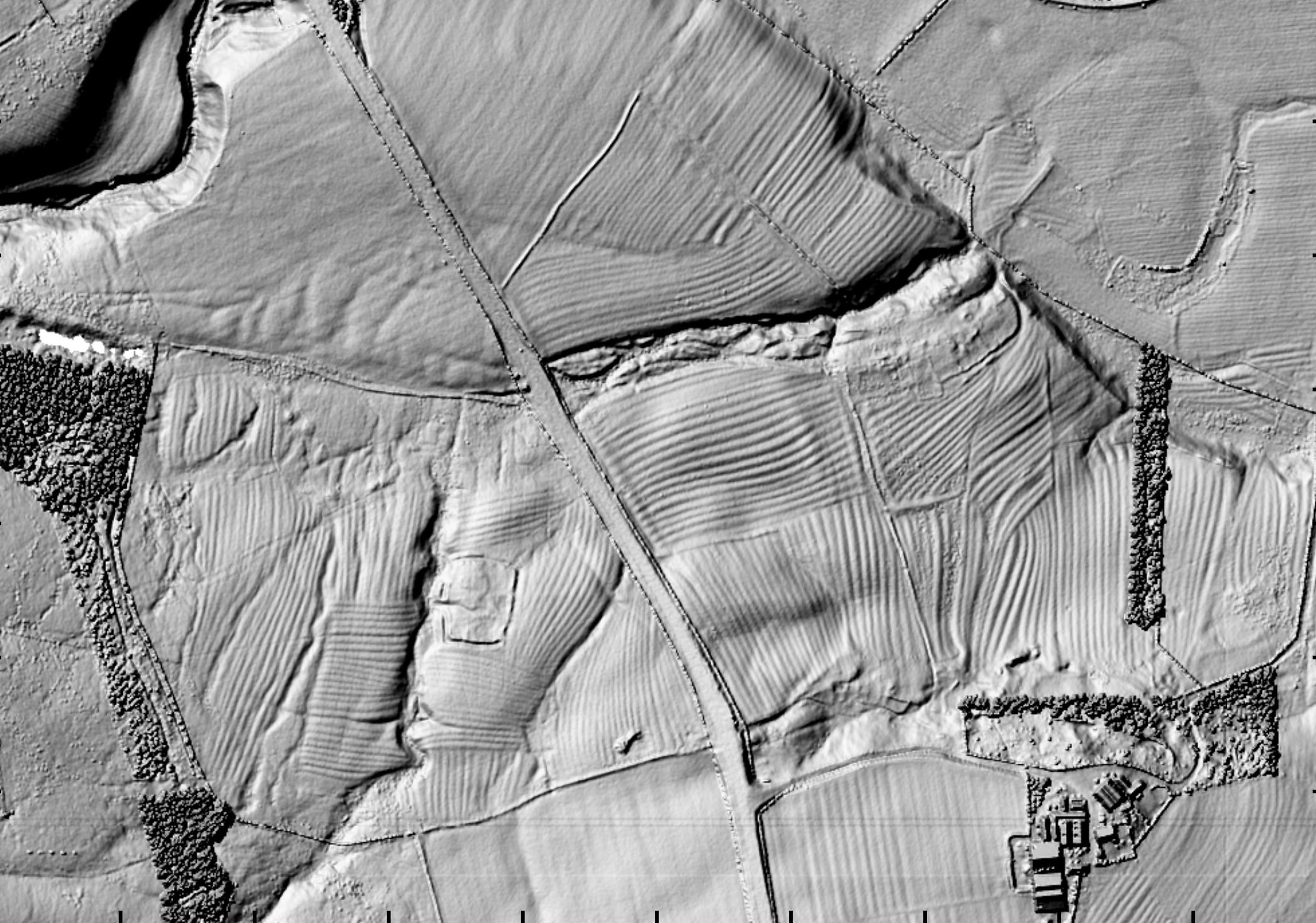
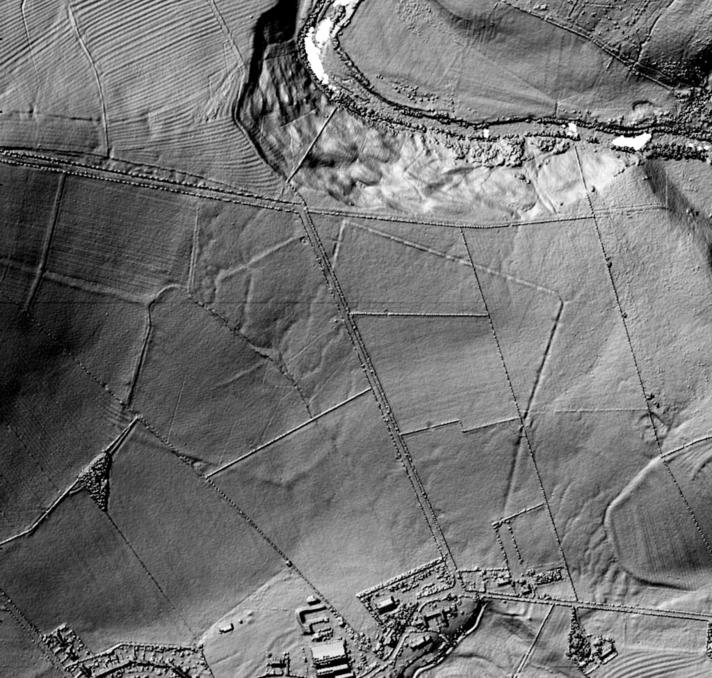
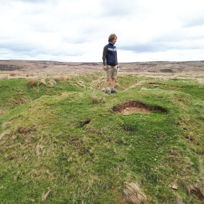
The Redesdale Lidar Landscapes project has involved volunteers undertaking archaeological landscape survey throughout Redesdale, using Lidar (‘light ranging and detecting’ or ‘light radar’) technology.
As part of the project, volunteers surveyed a whopping 333 square kilometres of Lidar data for Redesdale, recording a diverse range of sites, the majority of which were previously unrecorded. Following validation by the Project Consultant (Paul Frodsham of ORACLE Heritage Services), 1348 new records have been created as part of the project and will now be made publicly available through the Northumberland Historic Environment Record (HER) – visit the Keys to the Past website to take a look.
The Lidar survey has revealed a wealth of new detail for many known or suspected archaeological sites, as well as many entirely new sites, with 80% of all sites being previously unrecorded. Discoveries made by this project include:
- Several Bronze Age cairnfields, ranging in size from half a dozen to upwards of fifty cairns, some with associated field systems. Many of these were previously unrecorded or only partially recorded.
- Two previously unrecorded possible Bronze Age ring cairn or burial/funerary monuments, forming part of a large Bronze Age complex.
- A small number of previously unrecorded probable Iron Age ‘hillforts.’
- Numerous previously unrecorded Romano-British/Iron Age settlements.
- At least one probable unrecorded Roman marching camp and very significant new detail for other known camps.
- Extensive new evidence of medieval settlement and agriculture in Redesdale, including evidence of previously unrecorded or unlocated Deserted Medieval Villages.
- An extensive level of new detail on post-medieval agricultural and industrial landscapes.
You can read all about the project in our report below, which explains what we did and how as well as detailing some of the exciting things we found.
by Jennifer Care, Revitalising Redesdale Farming and Wildlife Officer.
This global pandemic has changed the way we do things. Our world seems smaller. For many of us life has slowed down. However, it’s a good opportunity to re-engage with our local area and learn about the wildlife on our doorstep.
I have always had a fascination with nature. I feel better with it around me and I love having a job where I can protect and champion our amazing natural world. However, it was not until last year that I took part in The Wildlife Trust’s 30 Days Wild challenge for the first time. This annual challenge to spend time closer to nature every day in June made me aware of how much I already do, reminding me to live in the moment and to appreciate the everyday miracles of nature. It’s started again this week and there’s still time to get involved http://wildlifetrusts.org/30DaysWild.
I get lots of wonderful wildlife with my job, but I still try to sneak in some extras. So, here are just a few of the marvellous moments of nature I’ve snuck into busy days of events, practical conservation, meetings and more in Redesdale over the past couple of years and ideas for how you can easily add something similar to what you do:
1. Take a nature photograph.
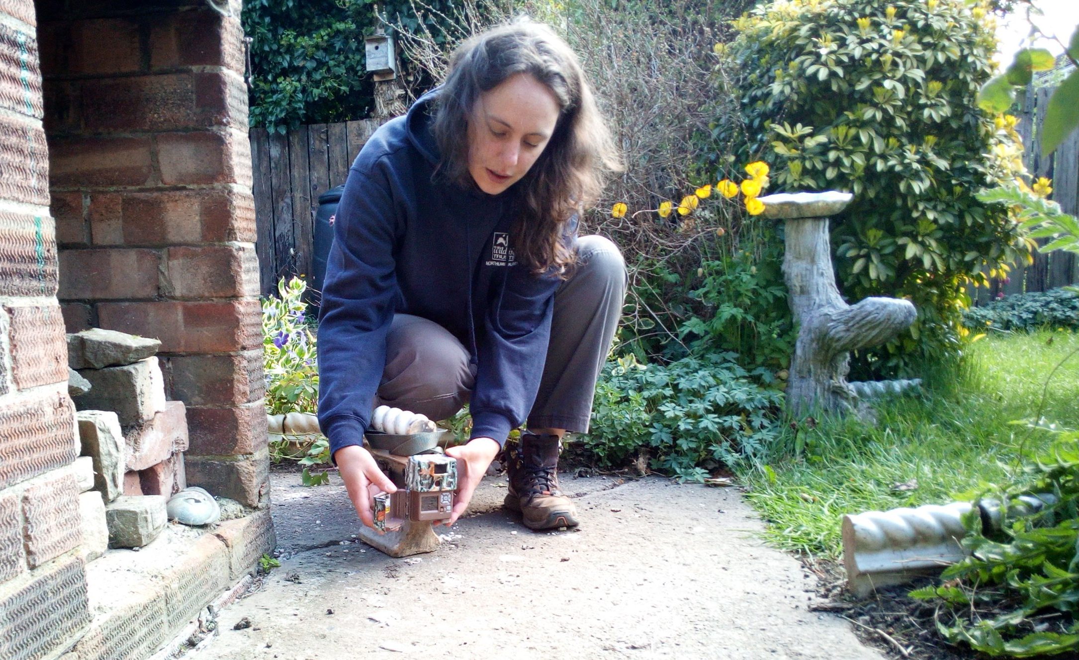
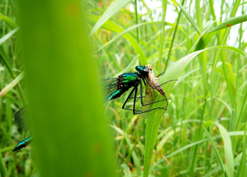
Last year I took part in a training day to learn how to do Modular River Physical Surveys (if you’re feeling nosy you can find out more about this citizen science project here). It’s a fairly technical and time-consuming technique to survey the geomorphology of the river, which we hope will be useful in providing a baseline and monitoring the success of our river restoration work. We spent time practising the survey methods at the river. It was a glorious sunny day and clouds of banded demoiselles were flying around. I took a few minutes out to try to catch them on my phone camera…They were tricky to photograph, spotting me and moving away, but this male was perhaps distracted enough for me to get close, having caught a mayfly!
You don’t need to be a professional to use a photograph to get a closer look at something interesting or beautiful and perhaps you, unlike me, can even photograph your subject without a blade of grass in the way!
2. Learn something new.
One of the amazing things about the natural world is that it’s so large, diverse and continually changing that there’s always something new to learn! I frequently puzzle why, how, or what about things I see, but much less frequently remember to research the answers later. However, after my second sighting of this strange fungus on a sheep skull I took a photo and tried to find out what it is.
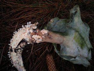
Sometimes these things get very complicated, with lots of similar species, but luckily this one was pretty distinctive. It’s called Onygena equina, commonly known as the horn stalkball. Apparently it is not often recorded due to its unusual habitat requirements: Its spores germinate better having first been through the gut of a herbivore; they then need to be excreted near a suitable carcass, as this fungus digests keratin and grows on putrefying horns and hooves of cattle and sheep. It’s amazing the way everywhere is home to something!
The trick is to be curious. Wonder. Then go and find out.
3. Eat outside
This one is a bit of a cheat really – when on a practical conservation task, removing non-native Sitka spruce regeneration from a peat bog, where else were we going to eat but outside?! However, that’s the thing about meals, it’s a pause, so where better to spend that time than outside on a beautiful day. With the mosses and heathers as a cushion, a soundtrack of skylarks and expansive views (and of course a hard-earned lunch), I remember it as a perfect setting to immerse in nature.
You can do it at home. Take a sandwich outside. Perhaps go barefoot if you have a lawn. Listen, look, feel.
4. Become a citizen scientist
Those who know me will know I’m a huge wildlife enthusiast, constrained by too little time and too many interests. I dip into a few different surveys and submit sightings to the local records centre. However, for the last few years, much of my spare-time wildlife activity has been focused on birds, participating in the BTO bird ringing scheme and, more recently, their nest record scheme.
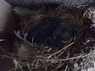
Last year I found this nest of swallows at one of the Redesdale community sites I was working at and monitored it. There were two chicks and both successfully fledged.
My photo is a bit dark, but if you’d like to see swallow chicks in Redesdale then, Wild Intrigue have a camera on a nest in West Woodburn. Look soon before the chicks fledge!
You can become a citizen scientist too just by seeing some wildlife and letting your local records centre know (in Redesdale that’s ERIC North East, but if you’re outside the North East then look up your local centre here). You just need to know what you saw, when and where! Remember that all wildlife sightings are important, even those of species considered common.
Alternatively, you can get involved in a particular study. There are many citizen science projects going on covering all sorts of different wildlife; find one to suit you here.
5. Change your perspective
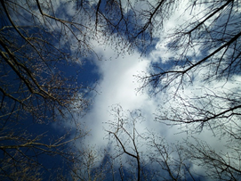
All this is very well, you say, but how do I actually find any interesting nature? My tip is to look at more than just what is immediately in front of you – change your perspective! Look up – watch clouds, see how tree branches can frame the sky, watch a buzzard or a skylark soar.
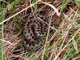
Look down and spot vole tunnels and latrines in tussocks of grass or beauties like this adder – he was basking on a road verge as I was doing a botany survey.
Look big, at hills, rivers, sunrise and sunset, and look small, at miniature landscapes of lichens and mosses, like this lawn of devil’s matchstick lichen with trees of heather at Benshaw Moor.
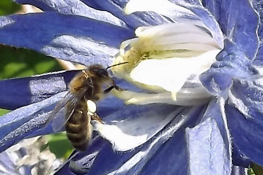
Test your imagination and think what it might be like to be one of our wild neighbours. What would the world look like (it’s not just about physical perspective – did you know bees see a different range of colours to us?!)? Where would you shelter or drink? How would you communicate? How would your offspring disperse?
Perhaps the more we can see things from a wildlife perspective the more we can see ways to help. If you’re feeling inspired, then a good place to start is The Wildlife Trusts’ host of ideas of simple things to help wildlife.
Finally, please share your wildlife experiences with others and help them connect with nature too (live wildlife webcam anyone?). Our natural world is facing a plethora of challenges and it needs all of us to help! For people to take action for nature, they first need to care. For people to care, they first need to know about the natural world and its wonders!
Perhaps learning to steal a moment with nature within our busy lives, marvelling at something different each day, is a good step to keep when normality (whatever it will be) resumes.
As promised, this week’s ‘My Revitalising Redesdale’ is the second part of our Battle of Otterburn double-bill. If you missed last week’s, catch up here.
Join historian and author John Sadler for an in-depth look at our current understanding of how the Battle of Otterburn played out, what we do and don’t know and some competing theories surrounding the battle’s location.
A huge thanks to John Sadler for sharing this video with us! An intriguing story, expertly told.
Follow us on Facebook or Twitter to keep up to date with any developments and find out more about the project on the dedicated project page here.
We are handing over to Geoffrey Carter of The Battlefields Trust for this week’s My Revitalising Redesdale blog, the first of a Battle of Otterburn double-bill. Next week, Military Historian John Sadler will talk through the current understanding of how the battle played out, as well as the uncertainties we are hoping to shed light on through this project.
Geoffrey is leading on the Battle of Otterburn project, which is working with volunteers to research the story of the battle and with landscape archaeologists to locate where it took place. If you have been wondering: “What is going on at Otterburn?”, he is here to let you know! Over to you, Geoffrey:

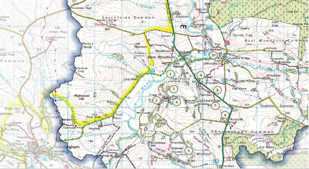
A huge thank you to Sue Thouret for this week’s My Revitalising Redesdale blog. This week we are taking you on a (virtual) guided walk around West Woodburn, East Woodburn and Ridsdale, taking in the astounding array of history on offer in this part of the Rede, Broomhope, and Lisles valleys. Sue describes ten historical sites you will see along the walk, encompassing over 2000 years of human heritage.
For downloadable route information and historical notes on this walk see the Corsenside Walks page and leaflets, which were produced by the Redesdale Ramblers with funding from our Community Heritage Fund.
“The Corsenside History Walk is a perennial favourite with Redesdale Ramblers. It is a walk that we can do in all seasons although it can be very muddy in certain areas after rain. It is a walk that we change the route on every time we do it so we never really walk the same way twice! We have now added various detours and additions from the original published walk to take in certain historic view points. Anyone doing this walk should take care to follow the country code because the rights of way go through farm land with livestock at certain times of year. It is therefore not really suitable for dog walkers.” – Sue Thouret, Redesdale Ramblers
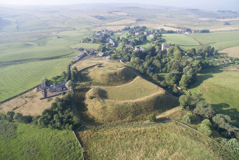
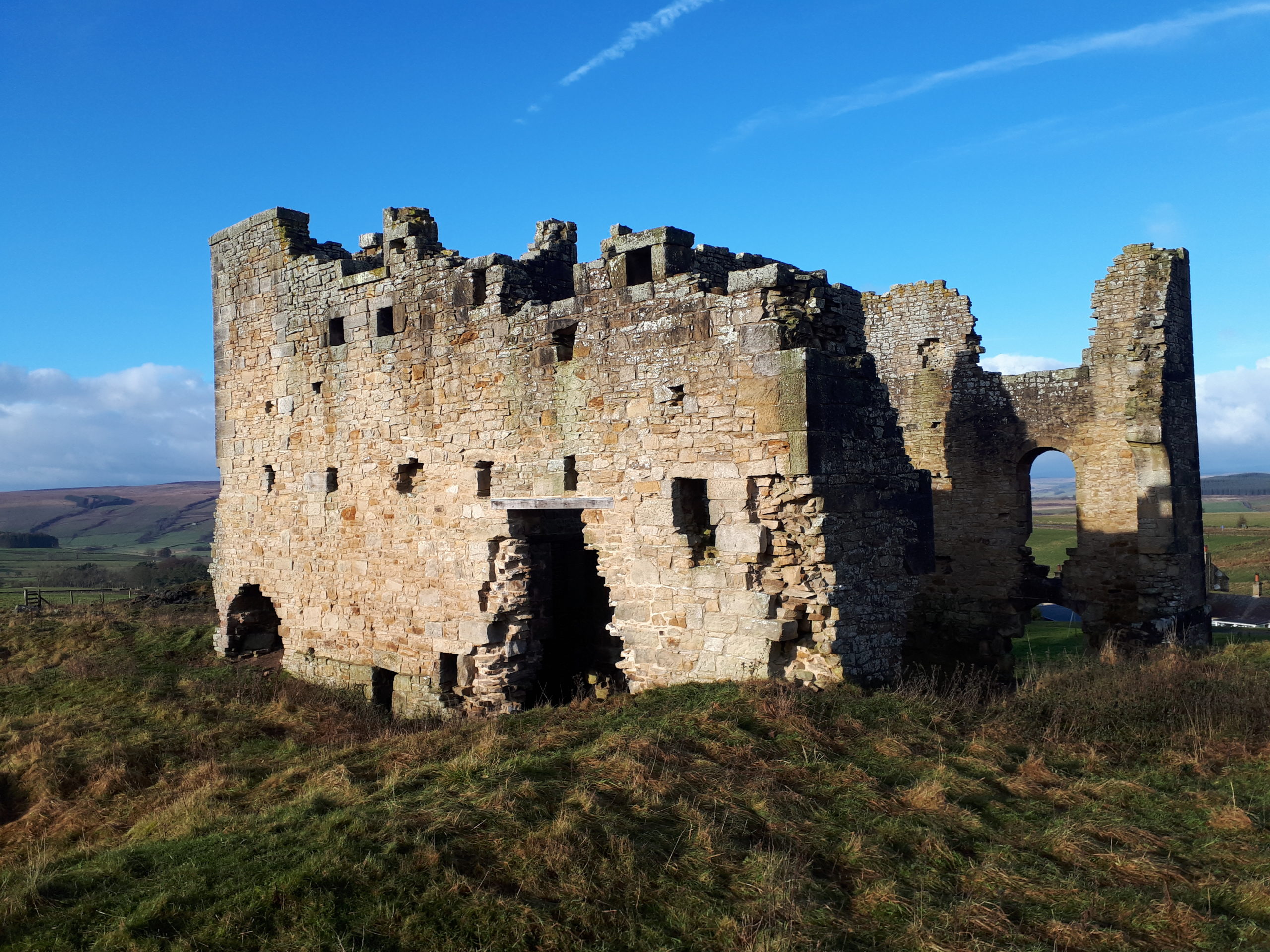
1. Habitancum
Habitancum was an ancient Roman fort located at Risingham near West Woodburn in Northumberland. The fort was one of a series built along Dere Street, a Roman road running from York via Corbridge to Melrose. The A68 in general follows the original path of this route. There was an active fort on this site spanning a period of approximately 200yrs.
The first fort of the Antonine period from about AD 139 was built for the second invasion of Scotland resulting in the building of the Antoinine Wall across Scotland between the Forth and Clyde rivers. The fort was destroyed in 197AD. It would have been a wooden stockade with earth works. A new Fort was built during the reign of the Emperor Severus on the same site in about 205/208 AD. The rebuilding would have been part of a major refurbishment of the Roman Wall and a far more substantial stone structure was built than previous. A little later the fort under went further reconstruction for unknown reasons. By 325 AD the fort was eventually abandoned.
The fort’s name is from Habitanci, an altar set up by Marcus Gavius Secundinus a consular beneficiary who served at the fort. Habitancum is well preserved and retains significant archaeological deposits. It is important as an example of a garrison fort which was in the frontier zone throughout much of the Roman occupation of Britain and for its role in various Scottish campaigns.
The fort seen today is in the classic rectangle shape with rounded corners, measuring 135m (450ft) by 117m (400ft) It had a substantial rampart and wall. The visible remains at Habitancum are of the fort constructed in the early years of the third century AD. An inscribed slab, uncovered during excavation, records the construction of the fort by a 1000-strong mounted cohort (one of the ten units of a Roman legion).
The remains of the walls of the fort are a substantial feature of what can still be seen. They are up to 10m wide with a height of 0.5 to 1.2m above the interior of the fort. The original walls were constructed of large blocks of local sandstone infilled with rubble and earth. Most of the large facing stones have been removed leaving only the rubble infill. The fort has three gateways. The west and south gates are seen as breaks in the wall about 8m wide with raised causeways over ditches, which would have surrounded the Fort. A gap in the centre of the northern wall is thought to be the site of a northern gateway. It is a Scheduled Monument protected by law (Historic England) but is situated on private land so permission must be sought from the landowner before entry. Dere Street passes to the west of the fort and would have crossed the River Rede near to Little Ridsdale.
2. Cragg Quarry
Cragg Quarry is situated about a mile south west of West Woodburn. It was a sandstone quarry which ceased production in the 1920s, but re-opened in the early 1990s and closed again around 2001. In 2005 a 10-year licence was granted for further extraction of Sandstone. According to Northumberland County Council, extraction from the site is intermittent depending on demand, and the site is capable of producing 3,000 tonnes per year. More recently it has been filled in and planted with trees.
3. Bell Knowe – Bronze age burial site
Bell Knowe stands on the same hill overlooking the valley of the River Rede, very close to Cragg Quarry. It is 16m in diameter and stands 1.4m high. In the centre is a hollow where 19th century excavation took place. Round cairns are prehistoric funerary monuments dating to the Bronze Age (c.2000-700 BC).
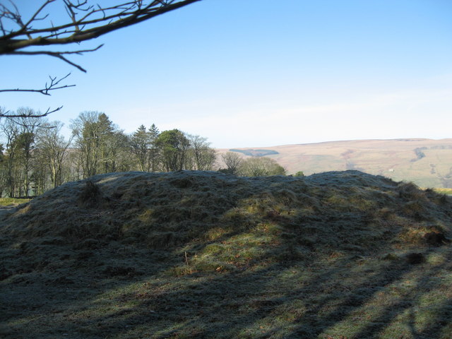
They were constructed as stone mounds covering single or multiple burials. These burials may be placed within the mound in stone-lined compartments called cists. In some cases the cairn was surrounded by a ditch. They often occupy prominent locations and are a relatively common feature of uplands. They are the stone equivalent of the earthen round barrows of lowlands areas.
Burial mounds can vary in form considerably and as a monument type they can provide important information about different beliefs and social organisations amongst early prehistoric communities. They are particularly representative of their period and many are considered worthy of protection. Bell Knowe round cairn has survived well and is still believed to contain significant archaeological deposits to add to our knowledge and understanding of Bronze Age settlements and activities in the area. This is a Scheduled Monument protected by law (Historic England).
4. The Wannie Line
The ‘Wannie’ Line is the local name for the Wansbeck Railway. Opened in the mid1800s, this railway was used to carry goods, minerals and also people between Morpeth and Redesmouth. It was closed in 1952, although a small section leading to Redesmouth station stayed open until 1963.
The Wansbeck Valley Railway Company opened the first part of the line from Morpeth to Scotsgap in 1862 and was extended to Redesmouth three years later. It is still possible to trace the course of the line, but parts cross private property and farmland. Many former railway stations are now private residences.
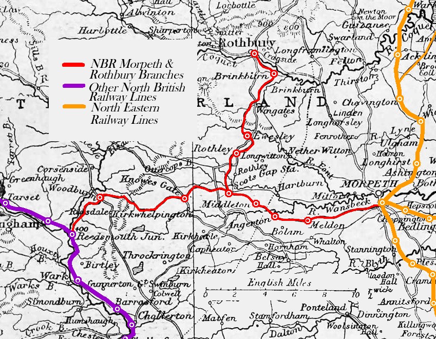
Leaving Morpeth, trains would stop at stations in Meldon, Angerton, Middleton North, Scotsgap, Knowegate, Woodburn and Reedsmouth. There were three passenger trains each way on the line, with separate goods trains. The sparse population did not encourage a more intensive train service.
5. Broomhope Valley
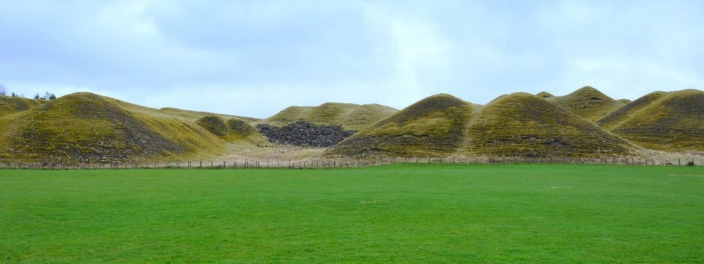
The discovery of large iron deposits in the Broomhope Burn Valley led to extensive iron ore mining, leaving spoil heaps that can still be seen and led to the establishment of the Ridsdale Iron Works in 1836. By 1857, the iron works were in difficulty because of poor infrastructure and bought at a knockdown price together with the mines by the industrialist Lord William Armstrong. For him the real prize was the mines.
Mining continued and the iron ore was calcinated in kilns at Broomhope and Hindhaugh, At this time the Wansbeck Railway had reached Woodburn so Lord Armstrong had a branch line constructed into the Broomhope Valley to allow easy transportation of ore to his Elswick Works. Some of the iron was used in the construction of the High Level Bridge at Newcastle.
The mines at Broomhope closed in 1879 when cheap Spanish imports of iron ore made them uneconomic. The spoil heaps have never been levelled and are now thought to be the finest examples of 19th century spoil heaps remaining. There has been talk of making them into a grade 2 listed monument. Because of its remoteness Lord Armstrong later established the Ridsdale Gun Range in part of the Broomhope Valley Quarry to test his big guns. The Ridsdale Range still remains in use today by BAE systems as its remoteness means there is less likelihood of injury to the public should anything go wrong during weapons testing.
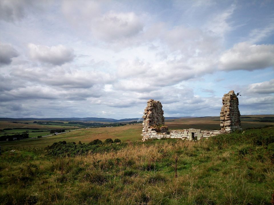
6. Ridsdale Iron Works
Many people passing through Ridsdale on the A68 mistake the remains of Ridsdale Iron Works engine house for the remains of a castle keep. They are surprised to discover this site used to house 3 furnaces, an engine house, coke ovens, kilns and reservoirs connected by tramways to the iron ore mines at Broomhope and nearby sources of limestone and coal.
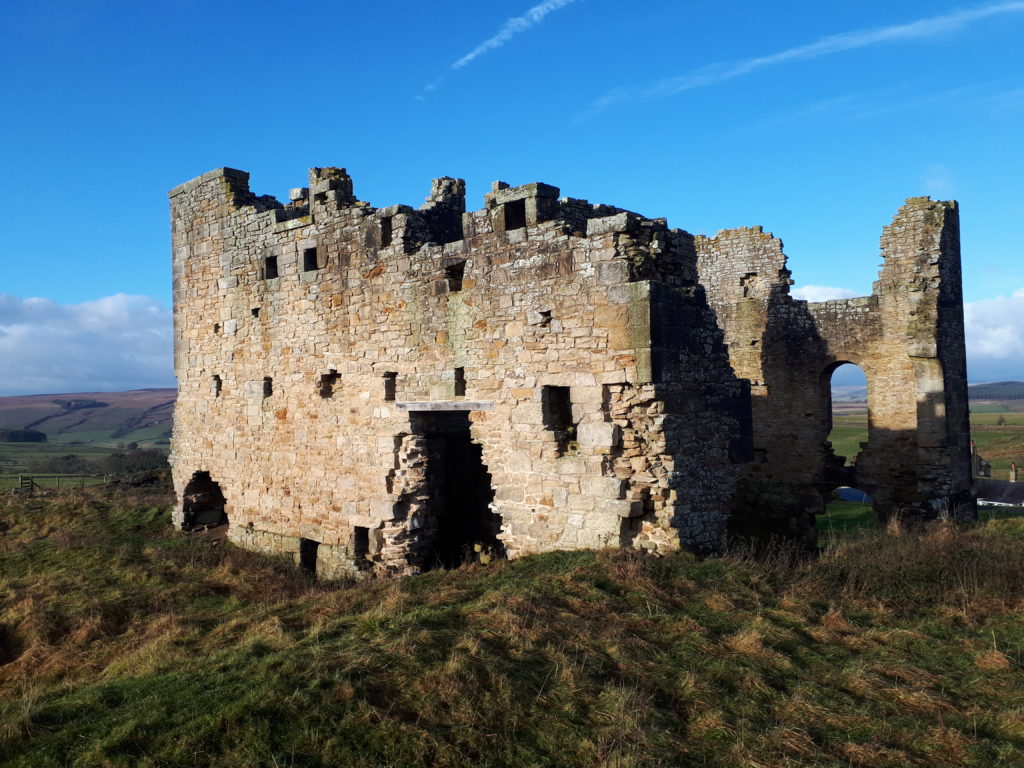
During the early part of the 19th Century, everything from wars, bridge building, the development of railways, and other new industries, fuelled exploration for new mineral deposits. The discovery of substantial iron ore deposits in the Broomhope Burn Valley led to the establishment of the iron works and the building of workers cottages at Ridsdale in1836. Because of poor infrastructure the works were failing by 1857 as all pig iron had to be taken by cart to Hexham.
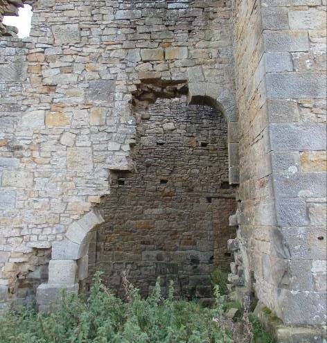
The works and mines were bought for a fraction of their worth by the industrialist Lord Armstrong, who asset-stripped the works as it was the mines he really wanted. Two of its furnaces were dismantled and taken to Armstrong’s Elswick Works in Newcastle. The closing of the Broomhope mines in 1879 marked the end of industrial activity in the area. A good amount of iron from the Broomhope Mines was used in the construction of the High Level Bridge in Newcastle, part of Robert Stephenson’s railways concept relying on T E Hudson’s detailed designs. The Ironworks is a Scheduled Monument (Historic England) and has been taken off the Heritage at Risk Register thanks to repair works carried out through Revitalising Redesdale Landscape Partnership.
Before Revitalising Redesdale repair work 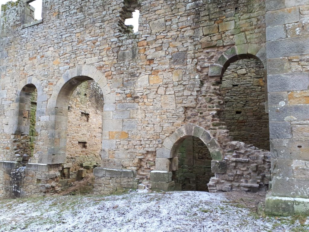
After Revitalising Redesdale repair work
7. Ridsdale Brickworks
Little can be discovered about the old brickworks in the Chesterhope Valley, other than it existed and it’s identified on old maps of the Ridsdale/West Woodburn area. It is known that the works were operational when the map was surveyed in 1863 but doubtful later when revised in 1896. Most industrial activity in the area had ceased with the closing of the mines by 1869, so it may be assumed that the brickworks suffered a similar fate.
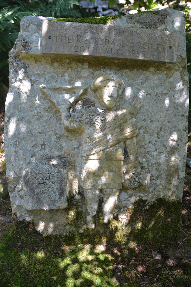
8. Robin of Risingham
Robin of Risingham is a Roman monument consisting of the lower half of what is thought to be a Roman religious figure caved in relief on an outcrop of rock. The Roman religion was the wholesale adoption of the Greek gods of antiquity which they made their own by adapting them to Roman or Etruscan beliefs, usually associated with fertility and vegetation. In turn the Romans too adapted the religious beliefs of the people whose countries they occupied.
The carved figure was first recorded in the 18th C. by Horsley and other antiquarians when it was in a complete state. It is estimated it would have been four feet tall. The figure is important because it is the only known example in Northumberland of a Roman statue cut from solid rock. Only the lower half survives because the then landowner destroyed it to stop people coming onto his land to see it.
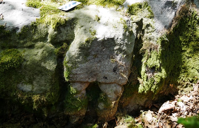
The original figure held a bow in one hand and a small animal, possibly a rabbit the other hand. He is wearing a tunic and cloak and is probably standing next to an altar. The figure has been likened to the Roman god of woodland, called Silvanus, but in the guise of the Celtic god Cocidius who was mainly described as a god of hunting. Beside the Roman carving there now sits a half-sized replica of what was thought to be the original, put there in 1983 by the Redesdale Society. The original carving is on the right hand side behind the replica and is a Scheduled Monument protected by law (Historic England).
9. Woodburn Station
Woodburn Station is now a private residence like many of the stations that used to be on ‘The Wannie Line.’ Look over the right hand wall of the old railway bridge where the A68 crosses where the Wannie Line used to be.
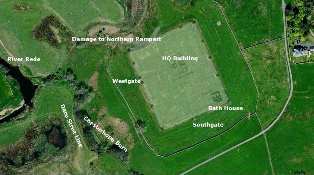
10. The Grange of Hallyards and Medieval Fish Ponds
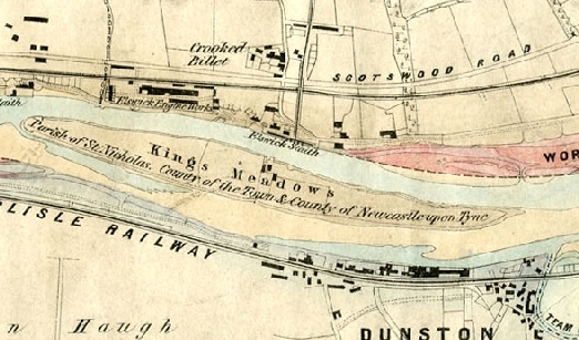
The Grange of Hallyards was the family seat of the ‘de Lisle’ family, situated near East Woodburn. All that can be recognized today are its fishponds. It may also have links to the parish church, dedicated to St Cuthbert which dates from the 12th century and stands on a hill overlooking Redesdale at Corsenside. The illustration below gives some idea what such early settlements may have first looked like.
Otwell de Lisle later built a stone tower. It was occupied continuously for some 450 years. The tower was said to have been built on top of a rocky knoll close to the road from West to East Woodburn, a few yards above the River Rede. It either fell down or was demolished when the de Lisle family vacated it. No one knows for certain, but the family name still lives on with the ‘Lisles Burn’ and Lisles Valley.
In 1827, the Rev Hodgson described ‘extensive masses of prostrate ruins’ on a site, but by the end of the 19th century a vicarage had been built near there, perhaps using the old towers stonework. Hallyards most likely position may have been where Townfoot Farm is today, though another site has been identified as the possible position for a Peel Tower in East Woodburn.
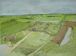
The fishponds at Hallyards were created to have slow moving freshwater for the purpose of breeding and the containment of fish to provide a constant and sustainable supply of food. Fishponds were widely introduced by the Normans after the 1066 invasion. The fishponds near to Townfoot Farm are extremely well preserved and contain significant archaeological and organic deposits. There are few such well-preserved fishponds in Northumberland and this set is of future value for further investigation. It is a Scheduled Monument protected by law (Historic England).
We hope you have enjoyed this virtual tour and will try the real thing when it is safe to do so!
Thanks again to Sue Thouret for sharing her research with us. In more normal times, Redesdale Ramblers have an annual programme of walks around Redesdale and its neighbouring valleys. Follow them on Facebook for more information and updates: www.facebook.com/RedesdaleRamblers/.
Please remember to follow the UK Government’s guidance on enjoying time outdoors responsibly: www.gov.uk/coronavirus
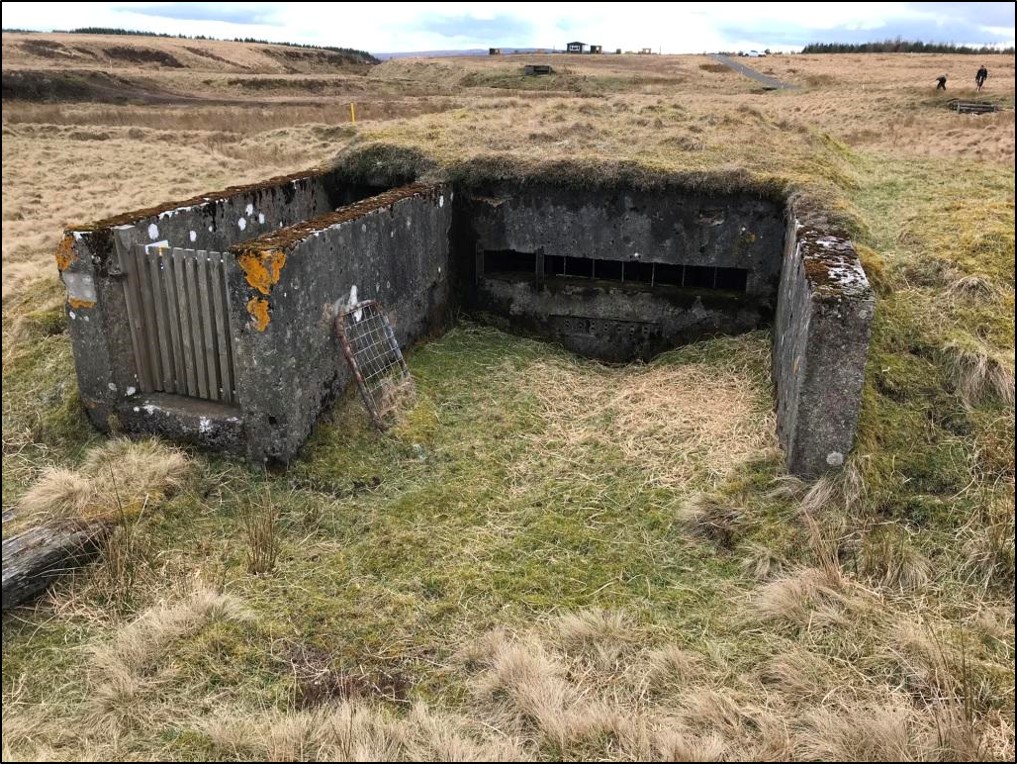
To help commemorate VE Day 75, this week’s My Revitalising Redesdale highlights a piece of Redesdale’s hidden wartime history on Northumberland Wildlife Trust’s newest nature reserve. Thanks to Duncan Hutt at Northumberland Wildlife Trust for sharing this with us.
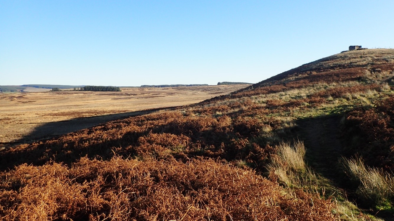
Benshaw Moor is Northumberland Wildlife Trust’s newest reserve. One of the aims of 2020 was to find out much more about the wildlife living on the site but it’s important not to forget the history and archaeology there too. Perhaps the most obvious remains are the World War II relics.

The Chain Home radar station at Ottercops lies, for the most part, on land next to Benshaw Moor but its outlying extras do extend onto the site. Chain Home was a series of early warning radar stations built before and during the Second World War for the purpose of detecting and tracking aircraft. The claim to fame of the Ottercops station was that it was the first to detect the light aircraft piloted by Rudolph Hess on his flight to Scotland in 1941. Hitler’s deputy’s mission is still shrouded in mystery but the tracking of his journey over British soil started here.
The radar station was defended by 4 light anti-aricraft sites in the local area as well as a set of pillboxes at strategic locations. One of those pillboxes sits at the highest point of the Trust’s site at the top of Benshaw Law. This is a standard type 22 pillbox with an added porch; a hexagonal concrete structure with views out over the site. Middle Hill, in the centre of the site seems to be the location of one of the anti-aircraft artillery sites although there is little left to show for this.
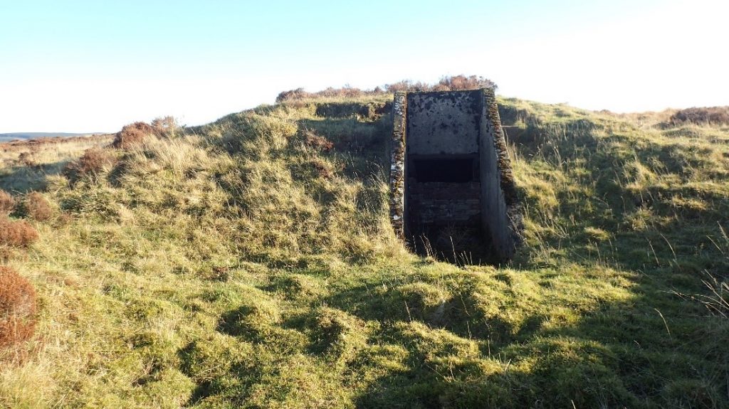
The other WWII relic is that of a small bunker, its entrance now largely bricked up. This was, most likely, an explosives store or magazine, situated away from the main installation and somewhat featureless inside, only the entrance way is visible.
There is much more to learn about the wartime history of Benshaw Moor, any additional information would be gratefully received. In particular we would like to get more evidence of the Middle Hill anti-aircraft position as all that now remains is a small cairn.
Information has come from:
The Pillbox Study Group
Keys to the Past
Reflections on meteorological conditions in Redesdale by Jennifer Care, Revitalising Redesdale Farming and Wildlife Officer.
From glorious sunny days, donning sun hat and sun cream, to cold days with sleet going sideways, attired in wellies, lots of layers and full waterproofs, leading practical conservation tasks in Redesdale has me out in almost all weathers. The challenge is to be prepared for the conditions on any given day.
This is not as easy as it sounds. The climate of the Rede Valley can be quite different from that in Newcastle when I set out. As confirmed by residents, weather also varies within the catchment and forecast predictions for Redesdale are not always reliable.
In late February 2019, I was working with volunteers helping restore an amazing peatland site near Elsdon, by removing self-seeded non-native Sitka spruce. In the space of only seven days we had magnificent sunshine (enough to bring out the sun cream), thick fog which reduced visibility to only a few metres and then snow!
I’ve learnt from experience that having options for extra layers is generally a good idea – and to make sure volunteers know to be well prepared too. Many of the volunteers are very experienced at this, bringing mats to sit on for eating lunch, waterproof bag coverings and even waterproof socks!
However, I was caught out last December. I was heading up a hill near Rochester with a group of volunteers for more peatland restoration work on a particularly wet site. It was late December, so cue plenty of layers, insulated wellies, fleece-lined trousers, full waterproofs, hat, welfare bag with spare warm gloves, hats etc. After a chilly start, the day became unseasonably warm and there is only so much it’s polite to take off or practical to carry. I ended up spending a day slightly uncomfortably hot!
Whatever the weather, I enjoy being out in Redesdale – if suitably prepared! In pleasant weather, it can be a relaxing and peaceful place, with big views, marvellous and unexpected wildlife encounters and amazing landscape. In inclement conditions, the wet, windy and wild weather can bring atmosphere and energy to the landscape, showing off the power of natural forces.
Then of course, after a cold, wet day out, there’s the heightened appreciation of being back in the warm and dry at the end of the day!
No practical conservation tasks are taking place at the moment, but if you fancy getting involved with this sort of volunteering later in the year then, after the restrictions imposed due to Covid-19 are lifted, please register as a Northumberland Wildlife Trust Conservation Volunteer at https://www.nwt.org.uk/get-involved/volunteer

In case you missed it, the Otterburn Training Area (OTA) featured twice in 2019’s Ministry of Defence Sustainability Magazine, Sanctuary. The two articles, Walking Underwater and Breeding Under Bridges (p.g. 40) and The Beauty of Bunkers (p.g. 68), highlight the unique natural and built heritage on the OTA, as well as the essential work to preserve and enhance it.
You can download 2019’s Sanctuary Magazine here.
Through our Life on the Ranges project we are working with the Ministry of Defence to carry out a variety of other works on the OTA, from peatland restoration to archaeological excavations. See our Life on the Ranges project page for more details.
Previous issues of Sanctuary Magazine can be found and downloaded here.

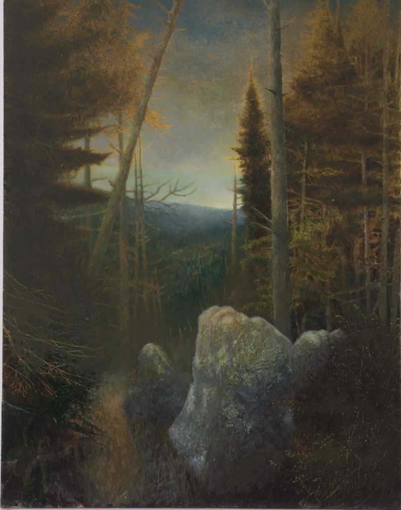
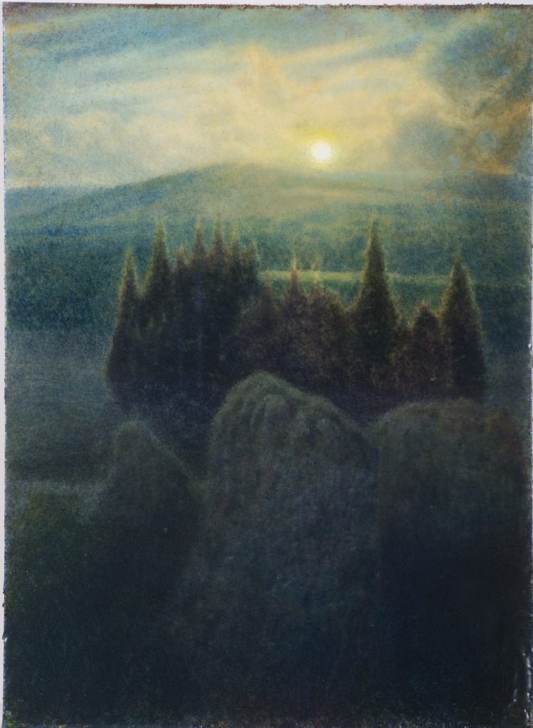
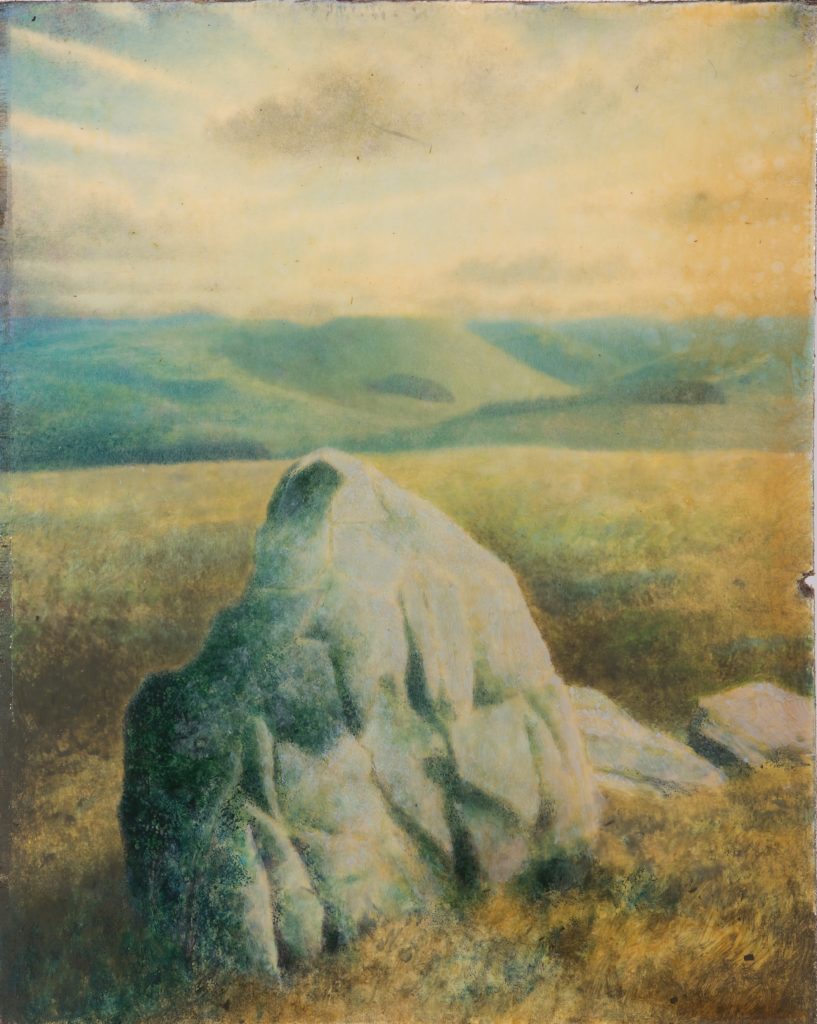
This week for My Revitalising Redesdale, we are taking a break from our team’s stories to bring you quite a different view of Redesdale and its neighbouring valleys through the beautiful and characterful art of Sam Douglas. Many Redesdale residents will recognise the location of our featured painting: The Three Kings, near Byrness.
Sam Douglas has spent ten months living and working at Highgreen, Tarset. He has been exploring the area and the wider Northumberland and Borders remote locations; much of this on foot or by bike. Sam has been fascinated by the ancient and more recent man-made structures that scatter the remote parts of the area and county – erected stones, cup and ring marks and remnants of industrial workings.
The Three Kings is a rare example of a Bronze Age ‘four poster’ stone circle. Although common in Perthshire and elsewhere in Scotland, only 22 have been recorded in England (Historic England), two of them in Redesdale and North Tynedale, hinting at a possible strong connection with communities north of the border. We contacted Sam to find out what his thoughts were about his charismatic corner of Redesdale:
“I visited the three kings fairly soon after arriving at VARC [Visual Arts in Rural Communities]; I always like to get hold of a detailed map when I go somewhere new and try and find any ancient sites marked upon it – especially standing stones [and] stone circles.
There is a forestry track close by to VARC which also doubles as part of the Pennine way that I cycled along to reach the Three Kings. It runs parallel to the busy A68 and offers nice views to the Cheviots. This became a fairly regular route for my evening cycles to get out into the landscape after a day painting in the studio.
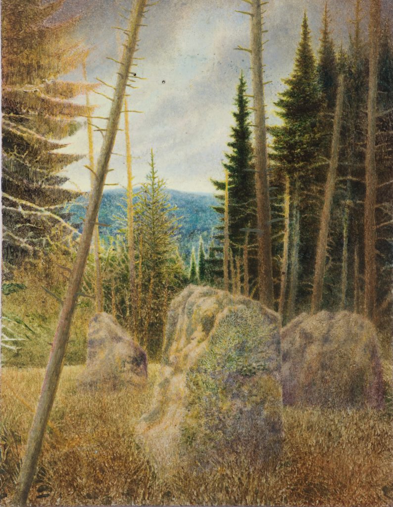
I found the artificial landscape of Kielder with its cycles of timber harvesting to provide an interesting contrast with the permanence of the Three Kings set within it – the stones themselves have some amazing Lichens growing on them, and now that the forest has been cleared around them, there are wide views across the valley and up onto the Cheviots.
I sat and drew the stones a fair few times as well as photographing them for reference material, there were often plenty of swallows flying around and also a good few midges – it was a good way to spend an hour or two.
I have since painted four different versions of the stones- in various conditions, before and after the site was cleared of trees. These are a part of a group of paintings which attempt to map out my explorations in northern Northumberland – with the Cheviots being a particular focus in this series.”
Sam has worked up drawings and photographs into paintings that focus on these remarkable features and prompt reflection on the nature and culture of our long relationship with the land. Sam commented:
“I really like the rural location and being able to walk or cycle straight out into a very interesting moorland landscape on my doorstep. The daily cumulative effect of this is important for me and my paintings and sketches have benefitted from the ease with which I can find inspiration and a sense of immersion in my work. The remnants of mining, archaeological sites and various other old structures that can be readily found or stumbled upon in the landscape have also provided me with much material to work with.
As I have followed various threads and interests, I have found local people (especially farmers) to be a good source of first-hand information on the history and remains within the area. There is also a quite distinct feel to the landscape in Northumberland which has been a welcome contrast from my last years of living in the South East – the low intensity land use of sheep farming, sparse population, dark skies and expansive views provide a quite distinct range of reference material to draw on as a landscape painter.”
Sam will soon complete the first residency in the multi-partner programme ENTWINED: Rural. Land. Lives. Art. Initiated by Visual Arts in Rural Communities, this programme explores, through artists’ practices, different aspects of what makes a ‘place’ and reveals the interconnectedness of rural land and lives. See www.varc.org.uk/entwined for more about the programme.
For more about Sam and to download his end of residency booklet as a pdf with a full essay by Alexander Marr visit varc.org.uk/entwined/sam-douglas/
You can see more of Sam’s work below, on Instagram @samdouglasstudio and on his website samdouglas.co.uk
Once we can get out on site again, we will be working with our partners in Forestry England to improve footpaths to the Three Kings. Watch this space!
Sam Douglas – Trestle Cairn. Oil on board. 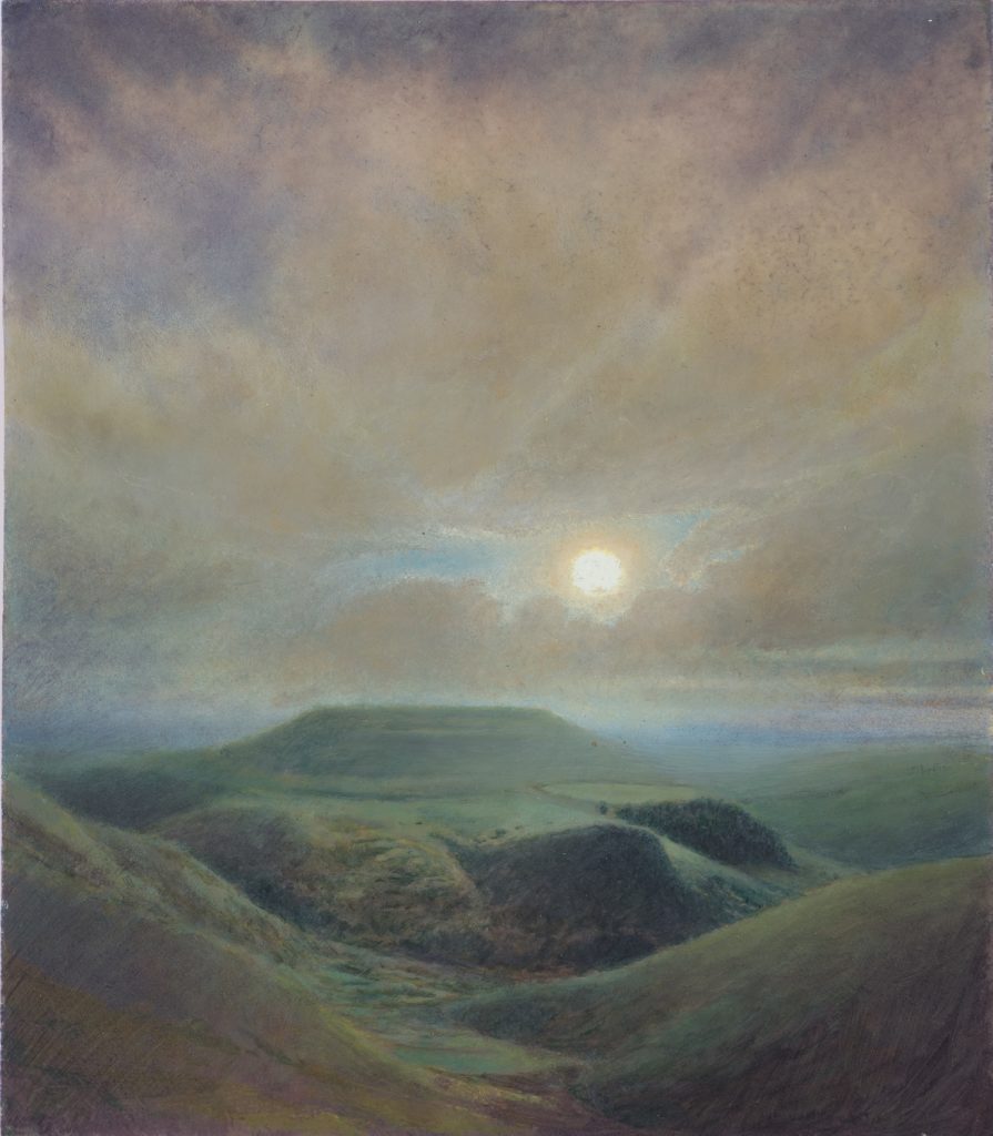
Sam Douglas – Woden Law. Oil on board. Sam Douglas – Tarset Landscape. Oil on board. 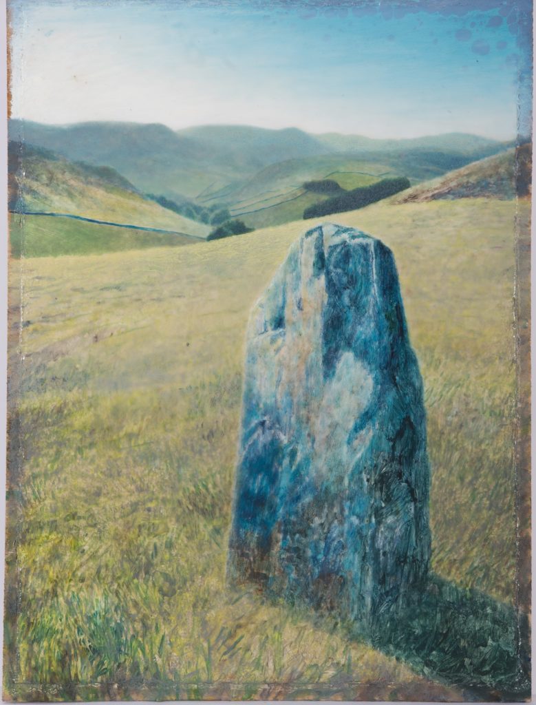
Sam Douglas – Standing Stone near Hownam. Oil on board. 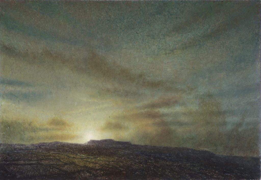
Sam Douglas – Simonside. Oil on board. 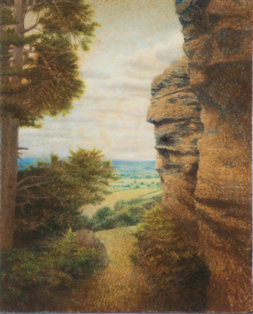
Sam Douglas – Shaftoe Crags. Oil on board.

Hello! It’s Nick Lightfoot, Revitalising Redesdale’s Programme Officer, here for our latest instalment of the My Revitalising Redesdale blog.
Discovering Redesdale
In December 2017, I was looking for a career change and came across a position with Natural England for a Revitalising Redesdale Programme Assistant. “Redesdale, I wonder where Redesdale is …” I thought to myself. Having grown up in Coquetdale, the next valley over from Redesdale, it may surprise you to hear that I genuinely had no idea. But this highlights what is so special about the Rede valley; it is one of Northumberland’s truly hidden gems!
As a keen rambler and cyclist, I took the first chance I had to spend a weekend exploring the valley’s byways. After a particularly hard ride on quiet roads, I found myself sitting in some late April sunshine outside the Bird in Bush, supping a local brew, and marvelling at my luck. How could somewhere like this have been on my doorstep without my knowing and where is everyone else!? Over the past two years, I’ve had numerous moments like that; they have given me a new perspective on the area I grew up so close to but have also highlighted the importance of the work we are doing through the Revitalising Redesdale Landscape Partnership Scheme. This is My Revitalising Redesdale.
More than just a walk in the countryside
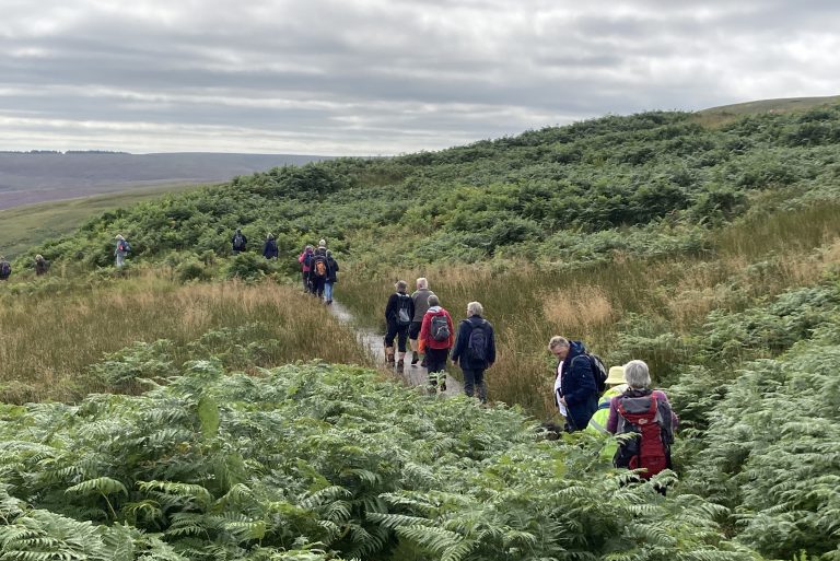
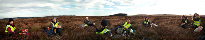
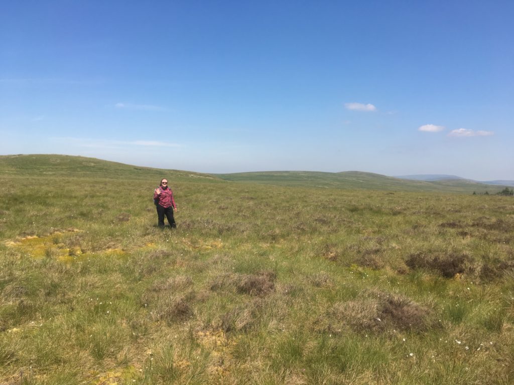
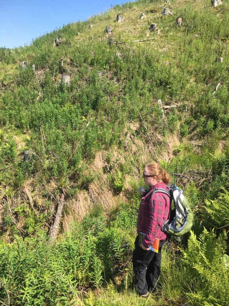
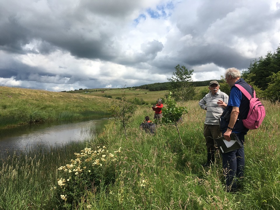
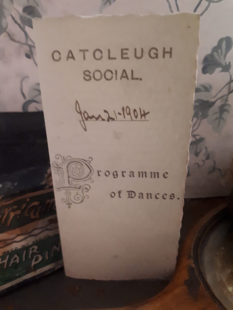
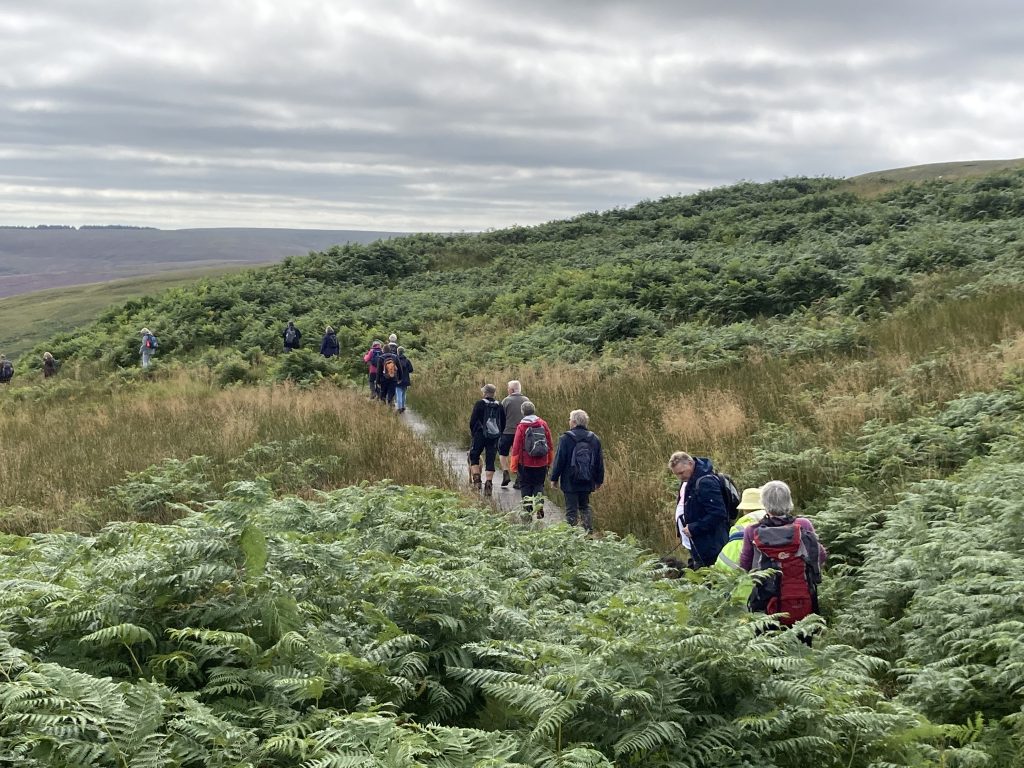
You may be glad to learn that my day job doesn’t normally consist of walks in the countryside. Most of the time, I pore over spreadsheets and reports, and work to balance cash flows for the programme. However, every now and again, a walk in the countryside is exactly what is needed and I would like to let you know about one of the best in Redesdale! Our Walk and Cycle Redesdale project aims to improve a set of circular routes centred around community hubs in the valley. One of the first routes we focused on is the Byrness to Heart’s Toe and the Border Ridge loop, at the very top of Redesdale. My colleague Karen, who wrote last week’s blog post, needed to survey the route to determine what signage and path improvements were required. Fortunately for me, she needed someone to come along for health and safety reasons and because it is easier to take photos, record GPS coordinates, etc. with a second pair of hands. Not to mention a dramatic improvement in conversation, albeit from a low base. Even more fortunately it was late June 2018, smack bang in the middle of our warmest summer in recent memory!
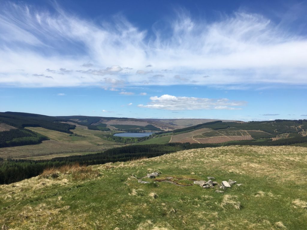
Leaving from St. Francis church, just south of Byrness, the route follows a steep section of the Pennine Way up Byrness Hill to a spectacular vantage point over Catcleugh Reservoir, Cottonshope valley, and Upper Redesdale. Most of the first half of the route is well sign posted and, barring a few incredibly muddy sections, didn’t need much in the way of improvement. In fact, the section from Byrness Hill to Ogre Hill is one of the most enjoyable ridge walks I’ve done in Northumberland; including, a south-facing perspective of the Cheviot and the grassed-over remains of Chew Green Roman Fortlet. Did you know the Romans built a fort next to the source of the Coquet? It was news to me, but that was becoming a familiar feeling working in Redesdale.
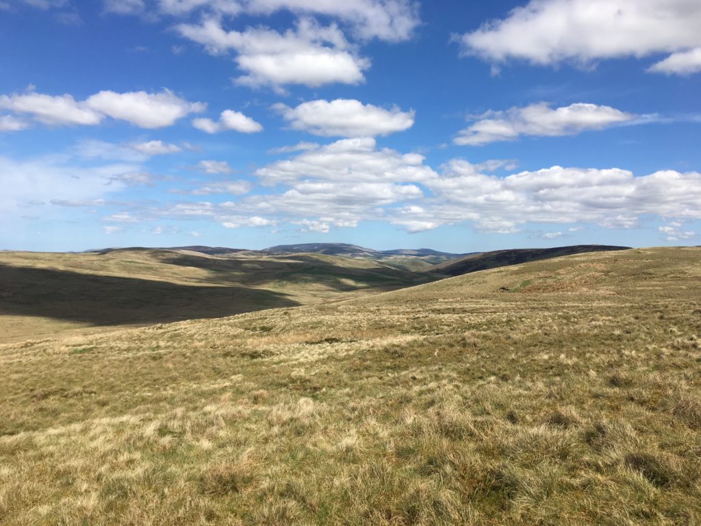
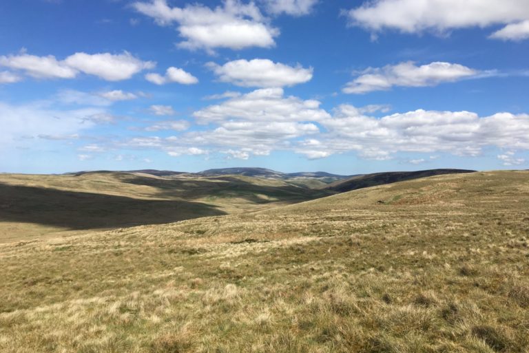
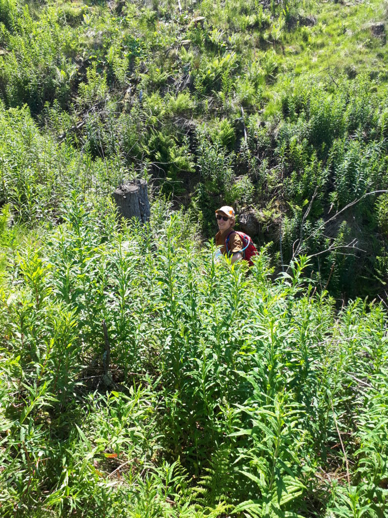
Once off the Pennine Way, there are two options – one for wet and one for dry weather. Usually, one is almost dry and the other is very wet. This is walking in the British uplands, after all! However, due to the exceptionally dry conditions we took the higher path to The Heart’s Toe, which leads you over the top of a peat bog. It was a disconcerting feeling to be walking over a peat bog and not see any water, as well as a worrying indicator of the Climate Emergency. The dried sphagnum, reminiscent of bleached coral, really hit home the importance of our partnership’s work in repairing peatland. According to International Union for Conservation of Nature, peatlands are the “largest natural terrestrial carbon store… provide safe drinking water, [and] minimise flood risk”, so they are a big deal to put it lightly. Nevertheless, as it is important to find a silver lining to any situation, we took advantage of the fine picnic spot looking over into the Scottish Borders.
The way down from The Heart’s Toe once followed a tributary to the Spithope Burn but had become impassable due to the mature conifer plantation. A section of the route along the south side of the burn was so overgrown and similarly difficult to navigate. However, a well-maintained forestry track handily avoided both. We noted GPS coordinates and cardinal directions for additional waymarking and decided that a diversion along the forestry track would make the upper Spithope valley much more enjoyable. The path connecting from Spithope Bothy to another section of forestry track and back to St Francis church looked straightforward on the map. A leisurely tea break in the well-kept bothy and a read of the guest book made for a restorative and entertaining break from the sun. We’ll be back in no time, we thought cheerfully.
“Can you see a way across?” Karen asked, looking across a steep, overgrown gully. “You’ll have to toss me” I joked – Lord of the Rings or Harry Potter references cropped up rather frequently throughout the day. From scrambling through jungles of harvested conifer roots to fording streams, this relatively short section of the route ended up taking a disproportionally large amount of time to navigate. After much hilarity, as we took turns disappearing into ditches, we made it to the forestry track and the last leg of our route. Our list of improvements suddenly much longer and legs much more tired!
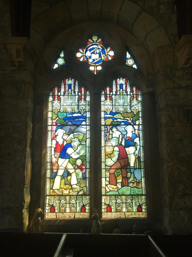
Once back to the car, we almost forgot look inside St Francis church, which would have been a real shame because it is home to a rare stained glass window. The window is a memorial to the men, women, and children who lost their lives in the building of Catcleugh dam in the early 1900s. It is one of the few examples of its kind to include no religious iconography; instead depicting the people who helped build the dam as well as a narrow-gauge railway, a potentially unique feature. This unassuming church feels like an analogy for Redesdale itself. It would be easy to drive straight past on the A68 but if you don’t stop to explore you’ll miss the best bits of this truly unique and inspiring landscape.
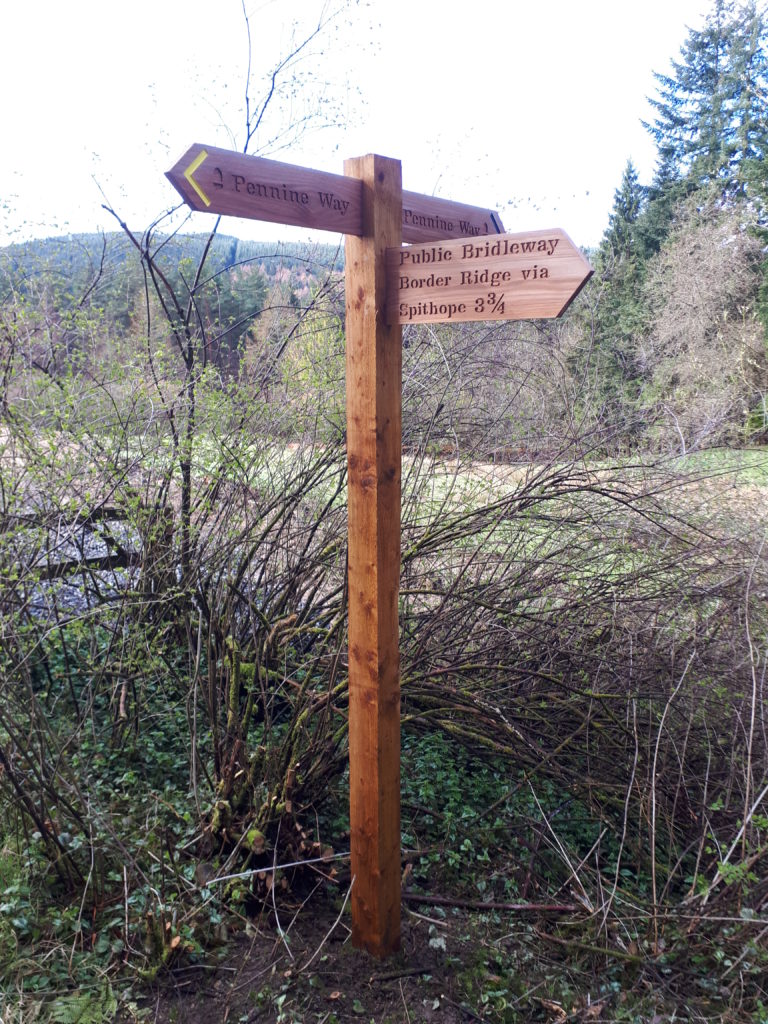
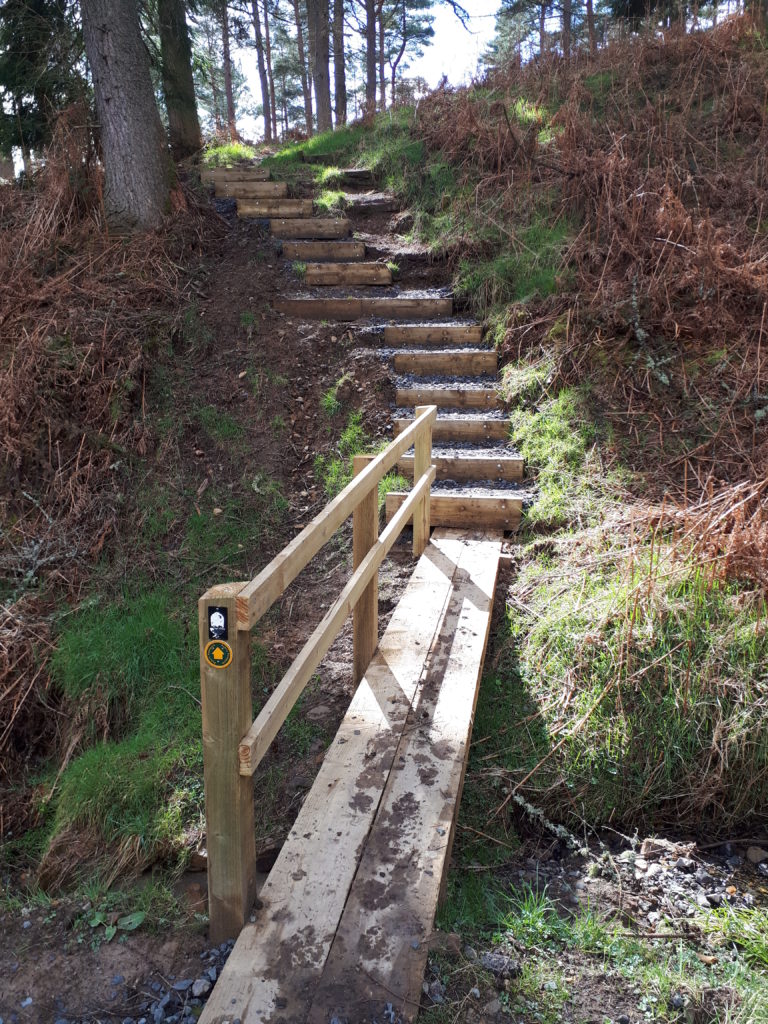
Improvement works to the Byrness to Heart’s Toe and the Border Ridge loop were completed in 2018, with help from Forestry England. Thanks to these improvements the route is now easily naviagble and a delight to walk!
Thanks to Karen for a welcome out of office excursion and the excellent company, of course!
Nick
As we’re all stuck indoors for the foreseeable future, we have decided to bring Redesdale to you through your computer/phone screens.
Over the next few months we will be sharing some of our highlights from the Revitalising Redesdale scheme and giving an oversight of what we’ve been doing and what it is like to work here; we’ll be sharing a new story each week.
We’d also really love it if you could share some of your stories about Redesdale. Perhaps you are a regular volunteer on practical wildlife/environmental conservation tasks, maybe you have taken part on one of our archaeological digs; you might even have delivered a project funded by our Community Heritage Fund scheme. However you’ve been involved, please send in your stories (with photos if you have them) for us to share with everyone through our website and social media pages, Email info@revitalisingredesdale.org.uk or direct to Team members.
This week: Karen’s story
I have been working on the Revitalising Redesdale scheme since March 2018. Although I had a strong background in community engagement projects and working with volunteers, for quite some time I had been longing for a chance to indulge my inner history/archaeology geek and get more involved in heritage projects. I can honestly say that working for Northumberland National Park on the Revitalising Redesdale project has been a dream come true.
From the very beginning I have had so many ‘pinch me,’ moment where I simply could not believe my luck that I get to work here, doing a job that both interests and excites me, in a beautiful part of Northumberland. I’ll be sharing some of my highlights with you over the next few months.
I’ll start with the obvious one…
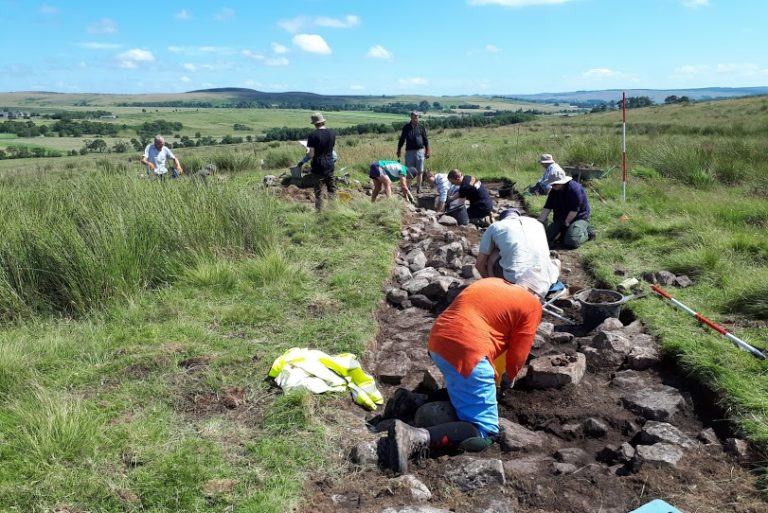
Rattenraw: The Beads/Drenched in a Trench
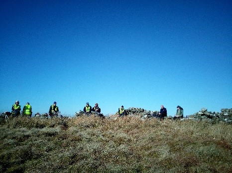
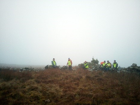
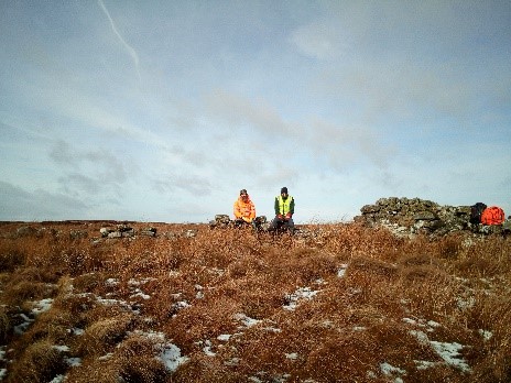
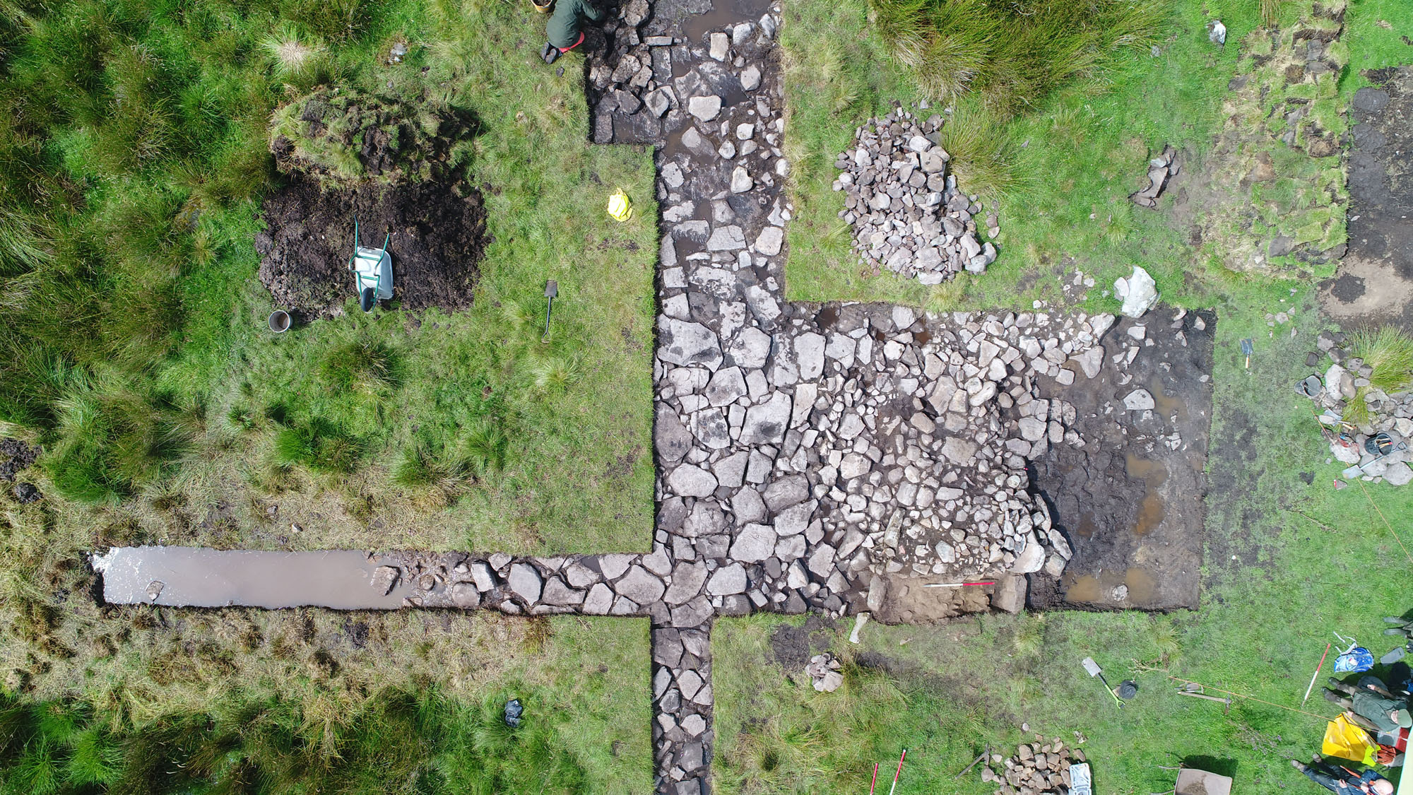
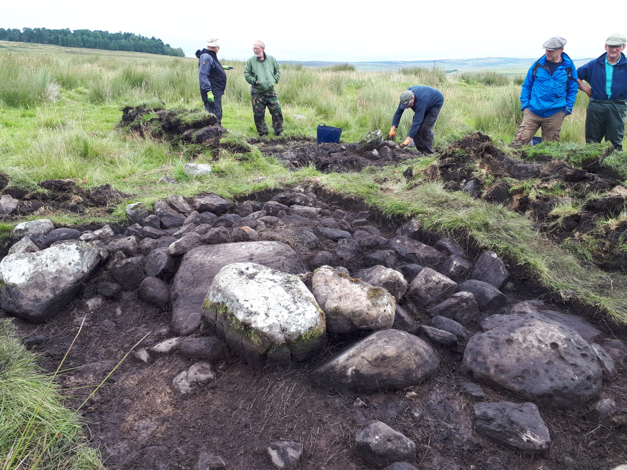
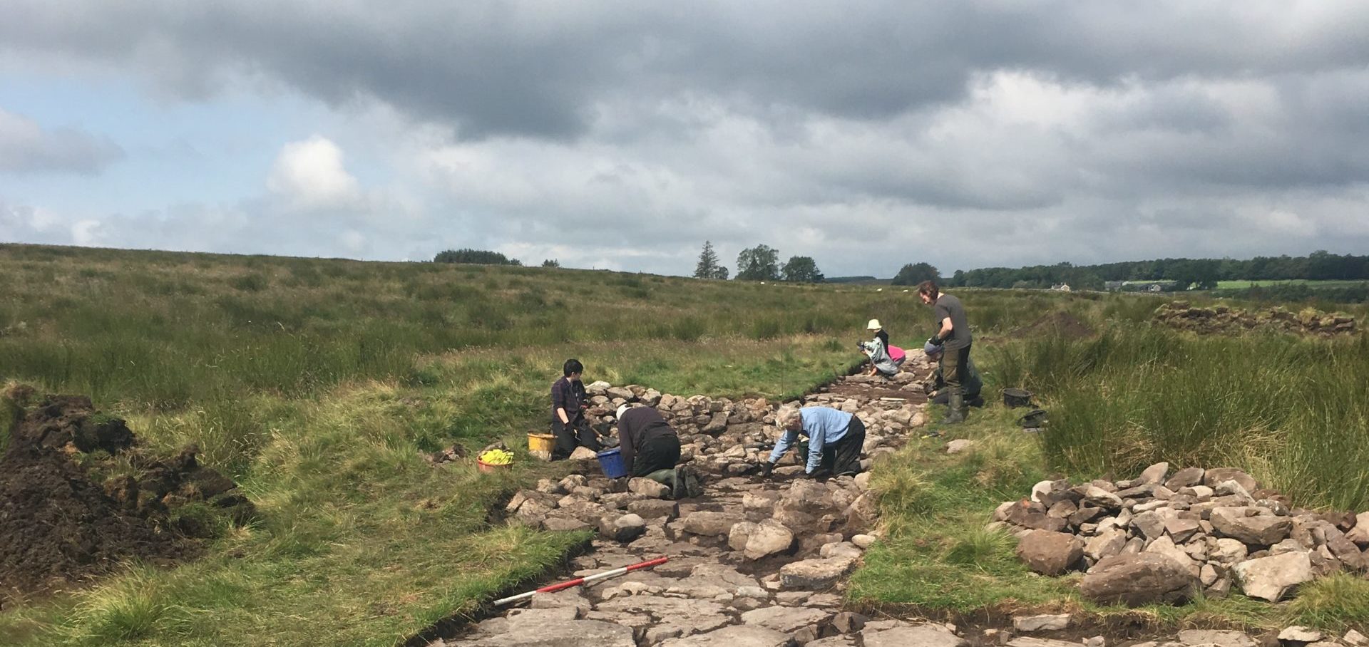
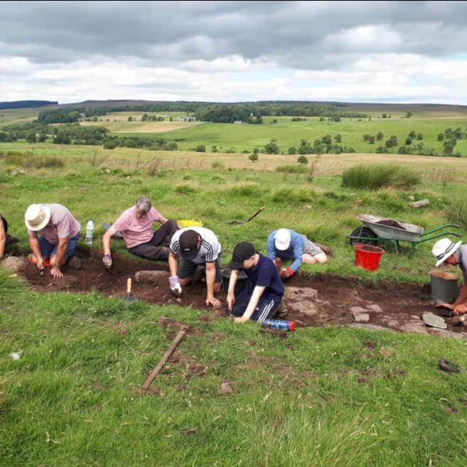
I had been wanting to take part in an archaeological dig for a long time, so imagine my excitement when I got to organise one, together with the fantastic North of the Wall Tynedale Archaeology Group (NOWTAG), Richard Carlton from The Archaeological Practice, and the very lovely landowners, Dennis and Susan Salt. We knew that we had a potentially very interesting site at Rattenraw and we knew what we thought it was, although you can never be entirely certain what you will find once you start digging.
This was going to be my first archaeological dig; I was excited but also nervous. I had various archaeologists telling me, “You won’t find anything, you know,” which seems to be the standard sentiment of archaeologists when approaching a dig. But I didn’t mind, I was just happy to be out at beautiful Rattenraw with a fantastic bunch of people, taking part in a dig.
The weather threw everything at us. On one day we had to down tools early because, incredibly, it was 30 degrees, there was no wind, and we were all just too hot. A couple of days later we had torrential downpours, only the hardiest of us ventured out and our trench resembled a muddy swimming pool.
But we kept going in our quest for archaeological knowledge, despite knowing that we probably Weren’t Going To Find Anything. Even so, I kept spotting flashes of green, hopes soaring dramatically that I had made an astoundingly important discovery, only to realise that it was in fact a blade of grass.
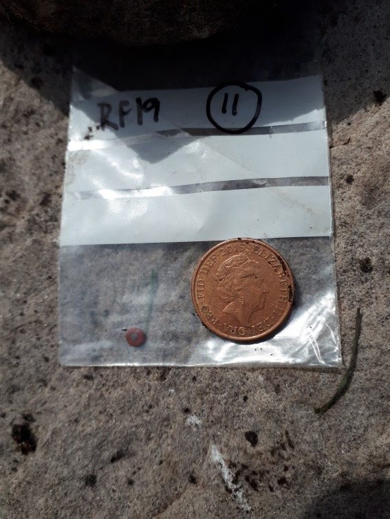
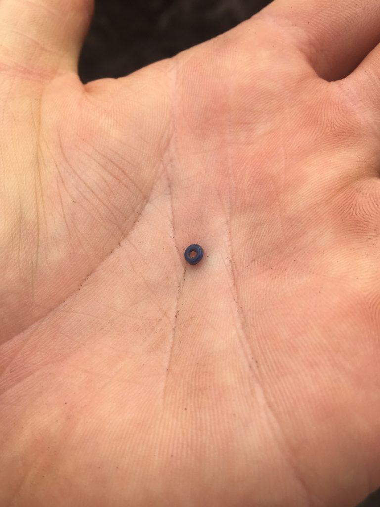
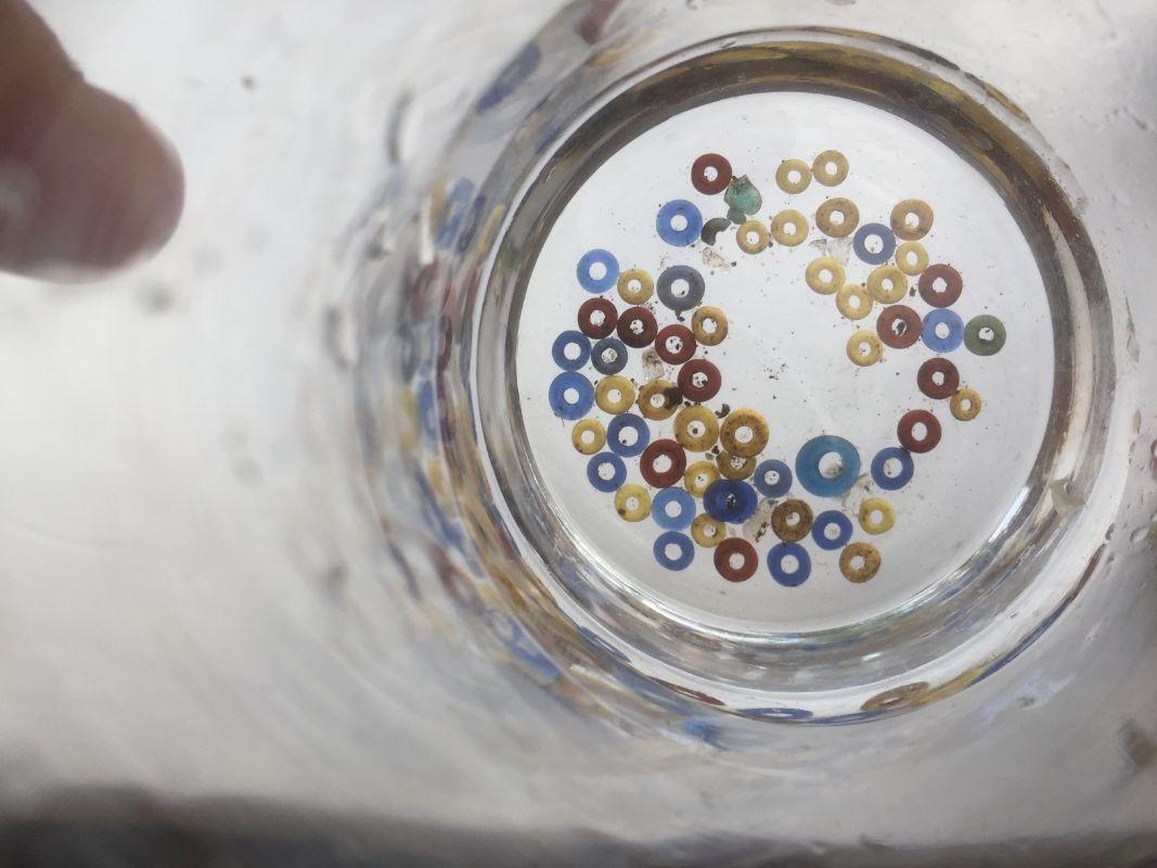
Towards the end of the eighth day of the 10-day dig, I spotted a flash of red plastic between the gaps of some stones I was ‘cleaning.’ Then I realised that these stones hadn’t been uncovered for centuries, so it probably wasn’t plastic. I carefully removed it, saw it was a tiny little round, man-made object and at that point was pretty certain I had made an actual Discovery. One of the volunteers, probably Barry, squawked, “You’ve got a bead!” And so it was; a beautiful, tiny, red glass bead, most likely Iron Age in date. Single beads like this do quite often turn up on Iron Age sites.
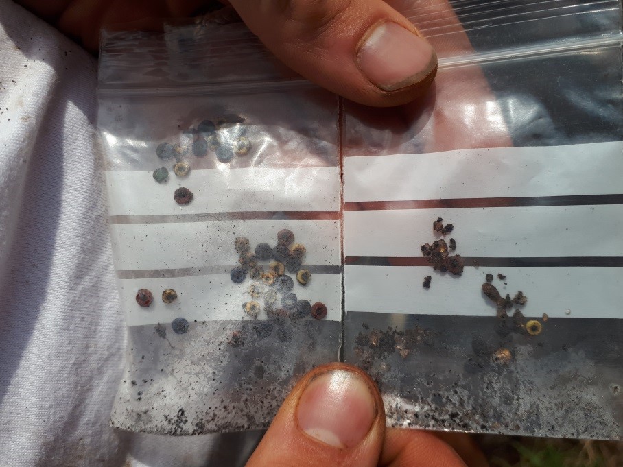
Sadly it was getting late, so the excitement ended there for the day. The next day, Day 9, I brought my colleague, Nick Lightfoot, along. He had never taken part in an archaeological dig either. I pointed out where I had found the bead and jokingly told him there was no pressure but he had to find one now too. A couple of minutes later he said, “I don’t mean to brag, but I’ve actually just found two of them.” And so he had – a blue and a yellow one. The jammy git had stolen my thunder.
Well, I couldn’t have that. I elbowed Nick out of the way and got back down on my hands and knees. Then, I remembered I should probably let other people have a go too, so a group of four of us painstakingly troweled the area. We found a few more, then a few more, then a few more again. Over the next hour or so, we pulled over 40 glass beads, of red, blue and yellow, from the soil. Marc Johnstone, an Archaeologist with The Archaeological Practice, was heard exclaiming, “This is a really, really significant find! This could even make Current Archaeology magazine!”
And the excitement didn’t stop there. Not to be outdone, one of the volunteers, James Pease, piped up with, “Is this gold?” And there, glinting up at us, was a glass bead that appeared to be covered in gold leaf. Nick and I had now both had our thunder well and truly stolen.
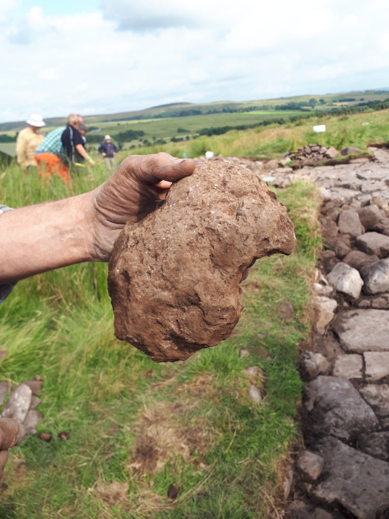
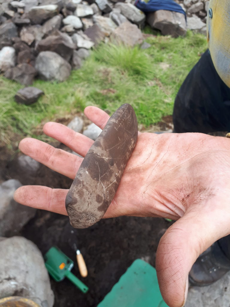
Then Richard Carlton came over, brandishing a piece of stone and yelling, “Forget the beads, this is what you should be getting excited about!” It was a fragment of Quern stone for grinding grain, which was a firm indication of late Iron Age date and that this was a domestic settlement where food was being processed. I’ve never seen anyone look so happy at finding a piece of stone.
Those weren’t the only discoveries we made: volunteers also found several pieces of pottery of Iron Age date, a cow horn and a Whet stone for sharpening tools, complete with both probable first century tool marks and 21st century trowel marks. On Day 10, volunteers found 12 more glass beads, including a single green one, bringing the total up to 58 complete beads, along with several broken fragments.
Not bad for my first dig. The moral of the story is: don’t believe archaeologists when they tell you that you aren’t going to find anything.
Whet stone 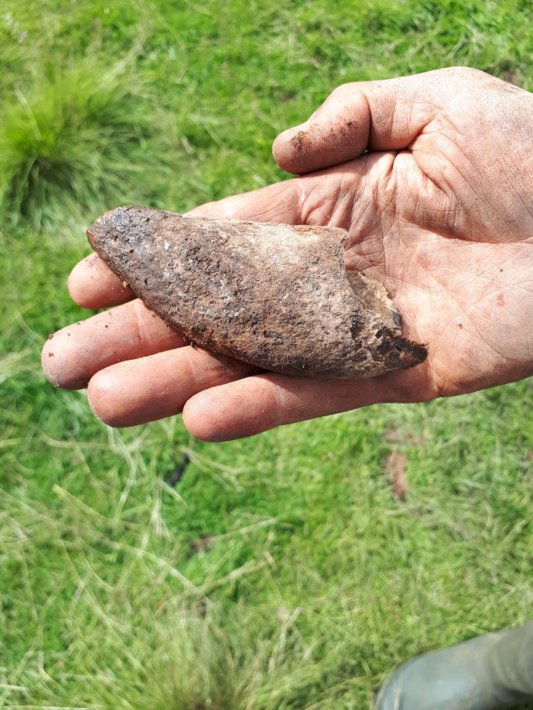
Cow horn 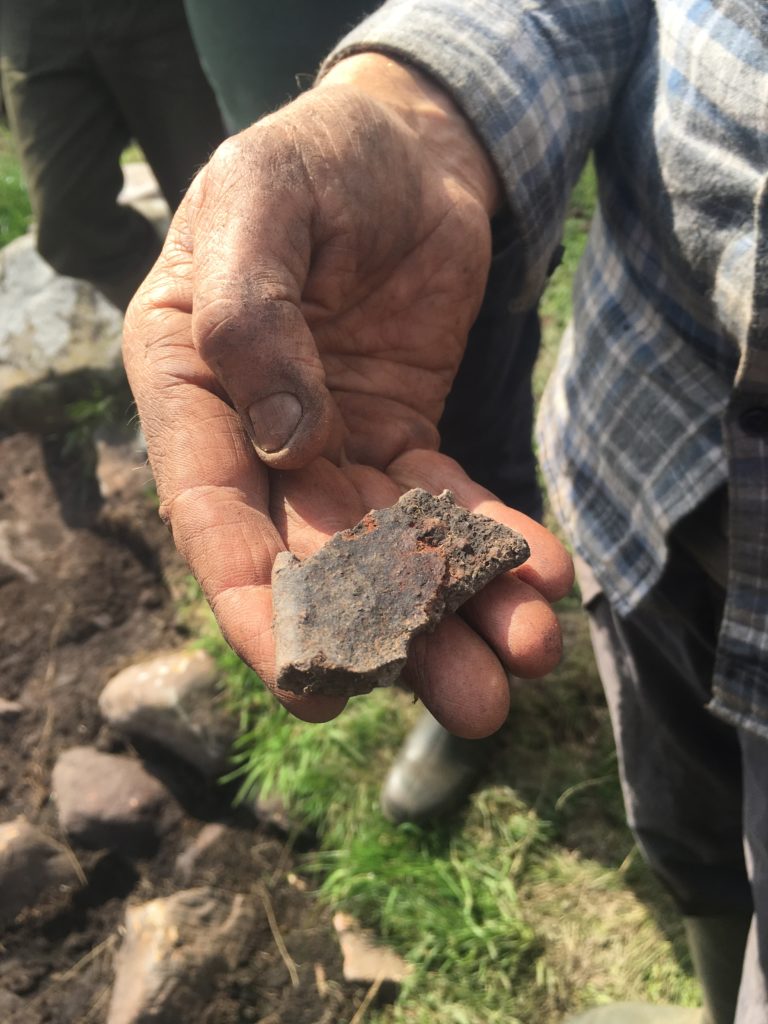
Iron Age pottery
The Future…
I would like to thank each and every one of our colleagues, volunteers, community members, partners and contractors for making this such an amazingly fabulous experience – you are all brilliant. I can’t wait to get back out there with you all.
Karen
Did you know the beautiful landscape of Redesdale has inspired several poets? One of the most famous pieces, ‘The Lay of the Reedwater Minstrel’, was written by Robert Roxby in 1809.
Andy Curtis, a seasoned Revitalising Redesdale volunteer, has written a blog post about this poem and Robert Roxby. It is a fascinating insight into Redesdale’s colourful and turbulent past.
Read the post here: http://heddonhistory.weebly.com/blog/the-reedwater-minstrel
Please note: Due to the current COVID-19 restrictions, there may be delays to scheduling of interviews and appointment for this position.
We are looking to appoint a confident and enthusiastic person to join our team in an exciting development role as a Revitalising Redesdale Trainee Assistant with a particular work focus on Northumberland Wildlife Trust’s newest reserve, Benshaw Moor.
Closing date: Monday 30 March 2020
Salary: This is a trainee post and is based on £16,305 to £16,689
Contract type: Fixed term / Working hours: Full time
Location: Northumberland Wildlife Trust, Green House, St Nicholas Park, Jubilee Road, Gosforth, Newcastle upon Tyne, Tyne and Wear, NE3 3XT
Find out more and apply: https://www.nwt.org.uk/jobs/revitalising-redesdale-trainee-assistant
Our River Rede Improvements Project was featured in the Winter 2019 edition of Northumberland Wildlife Trust’s magazine, Roebuck.
Download the full story here. Or visit out River Rede project page.
Our excavation of possible prehistoric features at Bellshiel was carried out in August 2019, in partnership with the MoD and Operation Nightingale. An archaeological evaluation report for the dig has been produced by Wessex Archaeology. You can download the full report here:
The main conclusions of the report are:
- Excavation of Site 1, a circular embanked feature with similarities to a Bronze Age ring cairn, did not reveal any internal features and no dateable material was recovered. It is most likely to be post-medieval or modern in date.
- Site 2, which was initially identified as a possible Bronze Age cairn proved to be two stone and earth clearance cairns of uncertain date. Radiocarbon dating was completed on two charcoal fragments found below the main cairn, which returned two late Iron Age/Romano-British dates. This means the cairns must post-date this and may relate to Roman or Romano-British field clearance.
- Site 3 proved to be a linear earthwork comprising a bank and ditch. A charcoal fragment was recovered but was not suitable for radiocarbon dating. It is likely that this feature post-dates the late Iron Age/early Romano-British period and may relate to land management and agricultural practices connected to two nearby Roman camps at Silloans and Bellshiel.
Plans are currently being developed to carry out future investigations of other potential prehistoric features in this area. Further information will be available here and on our social media pages.
Our excavation of an Iron Age/Romano-British enclosed settlement at Rattenraw was carried out in July and August 2019. An initial archaeological evaluation report for the excavation has now been produced by The Archaeological Practice. You can download the full report here:
The main conclusions of the report are:
- The site is confirmed as of Iron Age origin, by both structural elements and finds, which are typically dateable to the late iron age or Roman iron age period.
- The structural evidence, together with finds evidence suggests that the enclosure was occupied in the iron age and used for domestic and agricultural activities, as indicated by a fireplace, cooking pottery and a quern.
- Results of the excavation indicate that there were at least two structural phases to the settlement, revealed by a spine-like enclosure wall structure and layers of cobbled and paved surfaces.
- The ’roundhouse’ structures appear to have been of poor construction and may have only been used as animal pens, although one did appear to have a central hearth feature, which would indicate domestic activity.
- The extensive and good-quality flagged stone flooring is similar to that found at other Iron Age sites in the area, such as Woolaw and Gunnerton. Its purpose might have been to provide an effective working surface, or hard standing for livestock.
- A substantial ditch running between two roundhouses may once have been the original outer edge of the settlement, which was then subsequently extended.
There will be further research into the finds made and the results of this research will be published in due course. It is hoped that further investigations will be carried out at Rattenraw – further information and details will be available here and on our social media pages.
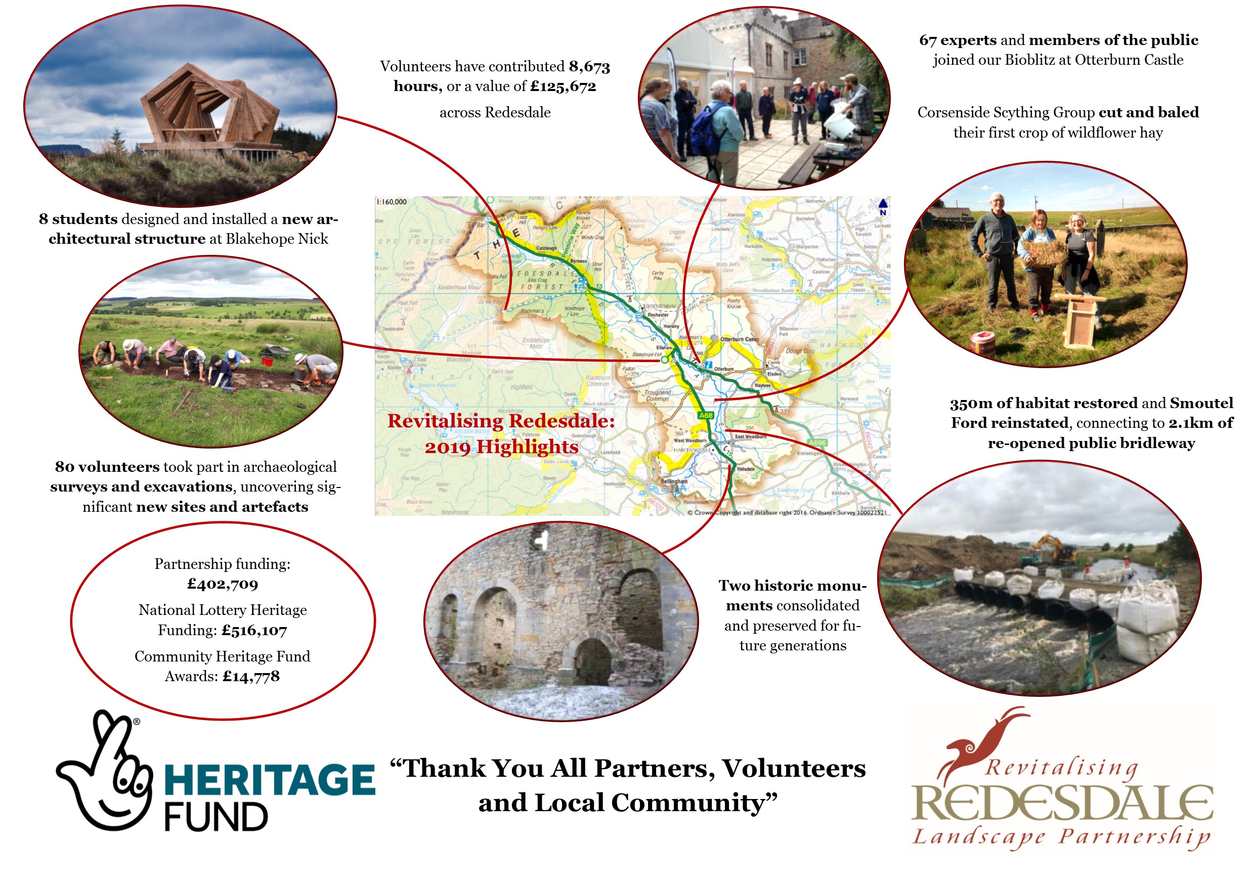
2019 has been a really exciting year for Revitalising Redesdale. We want to thank all our partners, volunteers, and the fantastic communities of Redesdale for their support and enthusiasm! See below a poster showcasing our highlights from 2019. These are by no means the only achievements, if you would like to find out more about what we have been up to in 2019, see our News page.
We are already looking forward to 2020 and hope to see some of you at our upcoming events:
- January 23, 2020 12:30: Corsenside Churchyard volunteers – Planning for 2020 season
- January 31, 2020 10:00: Learn to Care for Your Own Stream with Tyne Rivers Trust
- February 2, 2020 10:30: Guided Walk: Elsdon – from the Folly to the Gallows
- March 27, 2020 19:00: Dark Skies and Creatures of the Night
See our What’s On page for further details on all of the above and look out on our website for more updates on all our projects in 2020, including Battle of Otterburn, Redesdale Revitalises and Life on the Ranges.
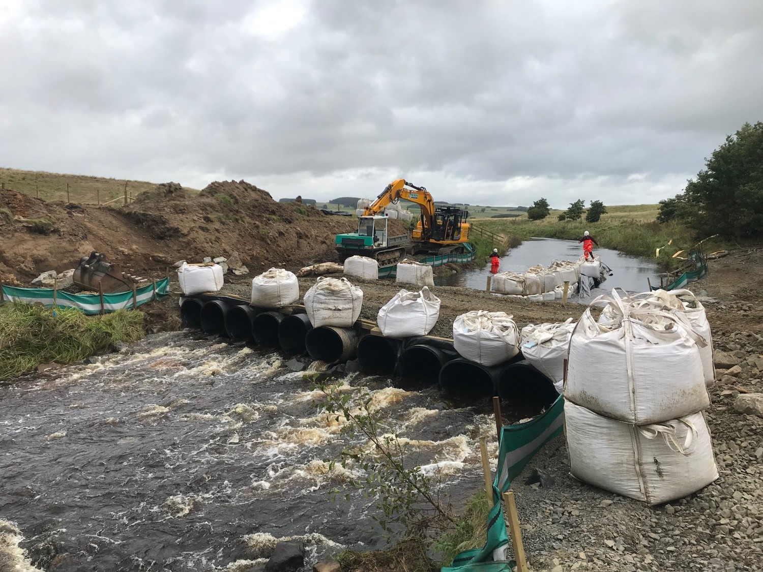
An Historic Crossing at Smoutel Ford is Reinstated
The Revitalising Redesdale Partnership has rebuilt the historic bridleway across the Rede valley, allowing walkers and riders to enjoy trails between Monkridge Hill and Otterburn for the first time in decades. The ford access work is part of the River Improvement Project. It is designed to mimic a naturally shallower part of the river in one of a series of cobbly riffle features. These rocky features are built across the river where gravels have been dug out in the past. They will help re-invigorate river flows, providing a healthier habitat for fish, river flies and our iconic Rede species, the endangered freshwater pearl mussel. The work will benefit river ecology beyond the 300m restored length, as well as improving access for people across the River.
The project has been made possible with funding from The National Lottery Heritage Fund, the Environment Agency and Northumberland County Council, through an active partnership led by Natural England and Northumberland Wildlife Trust.
Revitalising Redesdale will officially launch Smoutel Ford re-opening in March 2020. Find out more about this keystone part of our River Rede Improvement Project here.
Volunteers Trained in River Survey Techniques
In July, we worked with The Cartographer (with funding from The Water Hub) to train 8 local volunteers how to conduct Modular River Physical surveys, to monitor river habitat health.
Find out more about river surveys and volunteering: Tyne Rivers Trust

Farming and Water Event
In October, together with our partners we met Redesdale’s farmers and land managers to visit sites along the River Rede and discuss how they get involved with our River Rede Improvement Project.
Find out more about the event here

We’re saying #ThanksToYou to National Lottery players with free entry to our Dark Skies and Dark Deeds event
It’s the 25th Birthday of The National Lottery and we’re excited to be a part of the celebrations by joining in the #ThanksToYou campaign, celebrating the contribution of National Lottery players in supporting good causes over the past 25 years!
We will be offering free entry to our Dark Skies and Dark Deeds event to National Lottery Players with a lottery ticket on 30th November 2019:
Join us for an evening of storytelling and stargazing* Be thrilled and terrified by tales of dark happenings in Redesdale, featuring local pieces from Elsdon Writers’ Group and storyteller Jim Grant.
* Find out all about what you can see in the Redesdale night sky in our stargazing workshop (all equipment and instruction provided)
Present your National Lottery ticket to take up this special offer. Please check our full terms and conditions.

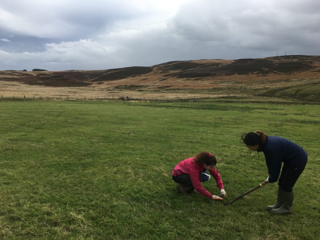
Another Successful Wildflower Planting Season
With the help of 28 volunteers from Northumberland Wildlife Trust and the Environment Agency, we completed wildflower planting at Rattenraw and Ravenscleugh farms for this year.
So far, more than 80 people have volunteered a total of over 135 days of time on our Re-flowering Redesdale project! We are incredibly grateful to every one of them. If you would like to get involved with wildflower planting or other practical volunteering opportunities, find out more here.
Volunteer Thank You Trip to Cocidius
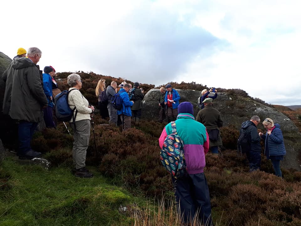
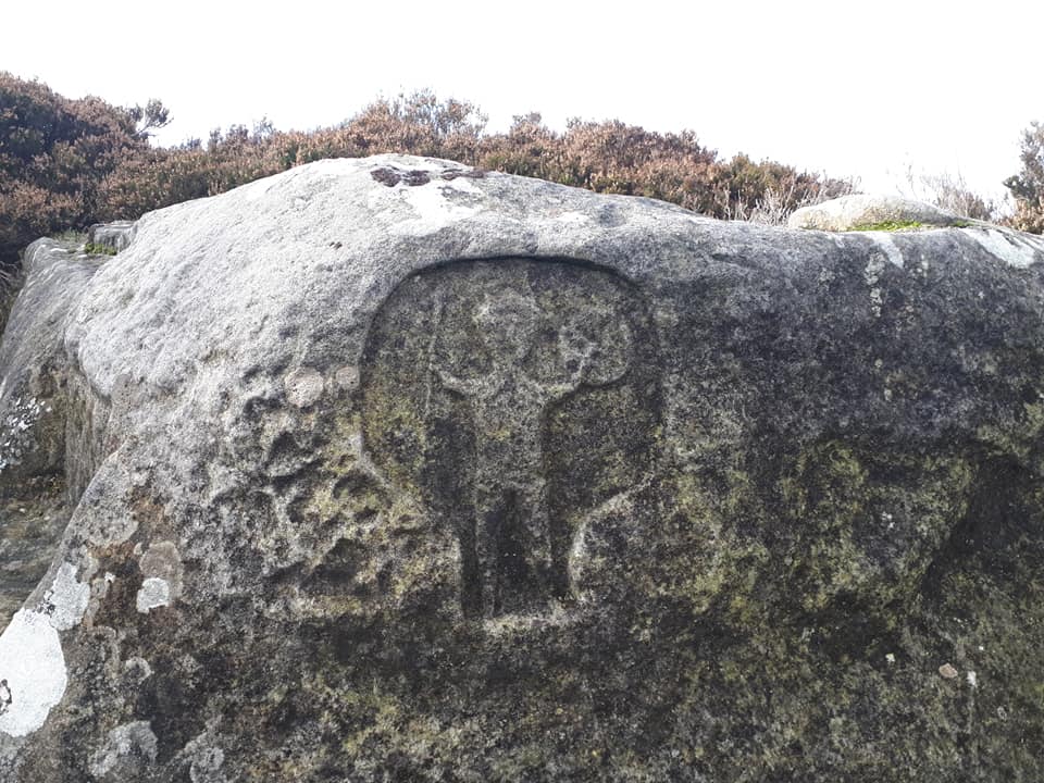
We had a grand day out for our heritage volunteers’ thank-you event on the 2nd November. The sun shone on our trip to the Romano-Celtic Cocidius shrine and High Shaw bastle on the Otterburn Ranges. We followed this with a delicious lunch at Elsdon Village Hall, provided by the Elsdon Tea Set and there was so much food that everyone went home with a goody bag too! A big thank-you to Phil Abramson for his informative talk and our colleagues at the MOD for allowing access to the Ranges.
Get Involved
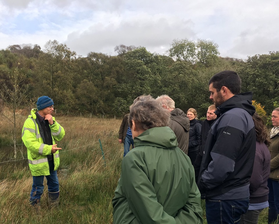
Lidar Landscapes – Interim Results Workshop – November 14, 19:00
Come along and find out the initial results so far from our Lidar (aerial archaeology) survey of Redesdale.
All welcome, but please let Karen know if you are planning on attending: 07741 194309, karen.collins@nnpa.org.uk
Address : Otterburn Memorial Hall, Main Street, Otterburn, Northumberland, NE19 1NP
Catcleugh Radio Play
We are delighted to announce an exciting opportunity for budding actors and anyone wanting to indulge their dramatic tendencies! We are currently working with Northumberland writer Rachel Cochrane to create a radio play centred on the lives of the workers who built Catcleugh reservoir.
We are now starting to look for actors to take part in the recording and a community performance of the play. The play features a host of local characters connected to the construction villages of ‘Gateshead’ and ‘Newcastle.’ If you would be interested in taking part, please get in touch with Karen: 07741 194309, karen.collins@nnpa.org.uk


Dark Skies and Dark Deeds! – November 30, 19:00
Join us for an evening of storytelling and stargazing.
We will be offering Free entry for National Lottery players to say thank you for their support. Present any National Lottery ticket on arrival to take up the offer. Booking essential. Please check our full terms and conditions.
Price : Adult – £8, Child – £5, National Lottery Ticket holder – Free (Buy Tickets)
Address : Rochester Village Hall, Rochester, NE19 1RH
Guided Walk: From the Folly to the Gallows – February 2, 10:30am
Enjoy a circular walk around Elsdon taking in views northwards to the Cheviots from Gallow Hill.
Date : February 2, 2020 10:30 am
Price : £5.00 (Buy Tickets)
Address : Elsdon Tearooms, NE19 1AA
Revitalising Redesdale’s Lost Redesdale community archaeology project worked with North of the Wall Tynedale Archaeology Group (NOWTAG) and volunteers to survey approximately 43 hectares of land at Chattlehope Farm, near Catcleugh Reservoir. The survey identified 27 sites of potential archaeological interest and trained volunteers in how to conduct a Level 1 Archaeological Survey.
The survey “indicates that the landscape around Chattlehope Farm contains a wide range of features evidencing human habitation and usage dating back into prehistoric times, as well as offering particular examples of continuity and change through medieval and post-medieval eras.”
Read the full report here

This year is the 25th Birthday of The National Lottery, and we’re excited to be a part of the celebrations by joining in the #ThanksToYou campaign, which celebrates the contribution of National Lottery players in supporting good causes over the past 25 years!
Since The National Lottery’s first draw took place on 19 November 1994, more than £40 billion has been raised for good causes in the areas of arts, sport, heritage and community – that’s £30 million a week making a difference to lives of people and communities throughout the whole of the UK.
To thank National Lottery players for their support, we will be offering free entry to our Dark Skies and Dark Deeds event on 30th November 2019. Anyone who presents any National Lottery ticket on these dates will be able to take up this special offer. Please check our full terms and conditions below.
As a recipient of National Lottery funding, Revitalising Redesdale Landscape Partnership has been able to reinstate an historic river crossing at Smoutel Ford, restored peatland at Whitelee Moor National Nature Reserve, save Ridsdale’s Ironworks from collapse, and award over £13,000 to local community projects . Find out more about the full programme on our Projects page. We are one of the hundreds of participating National Lottery-funded projects across the UK who are taking part in the #ThanksToYou campaign in this special Birthday year.
Terms & Conditions:
- One National Lottery ticket provides free entry for one person to the Dark Skies and Dark Deeds event.
- All National Lottery games qualify for free entry, including tickets from any National Lottery draw based game or National Lottery Scratchcard. Proof of ticket can be paper or digital.
- The offer is valid on 30th November 2019, 7pm-9pm, for the Dark Skies and Dark Deeds event only.
- Refer to our event page for further details.
- Pre-booking is required.
- We have the right to refuse entry in the unlikely event of venue reaching capacity, as well as unforeseen circumstances.
- Tickets to be shown at the entrance to Rochester Village Hall when visitors arrive with their National Lottery tickets to take up this offer.
“We hope that this award marks the beginning of Redesdale becoming a safe haven for one of our greatest natural treasures, the native honey bee.” – Dr. Dorian Pritchard, Redesdale Beekeeping Group
We are delighted to announce the Redesdale Beekeeping Group have been awarded £2,000 through our Community Heritage Fund for their work conserving the native honey bee.
The award will contribute to the building of a conservation apiary near Byrness. The Group will also run a programme of research, lectures and practical workshops in hive building, general beekeeping, bee wing morphometry (as a check on native status) and queen rearing aimed at non-beekeepers as well as developing beekeepers.
Find out more information here.
9th October, 2019 – Otterburn
We thoroughly enjoyed meeting Redesdale’s farmers and land managers this week to visit sites along the River Rede. With the help of our partners – Natural England, The Environment Agency, Northumberland National Park Authority, Groundwork NE & Cumbria and participating farmers – we had a great discussion about how farmers and land managers can get involved with our River Rede Improvement Project in a wide variety of ways.
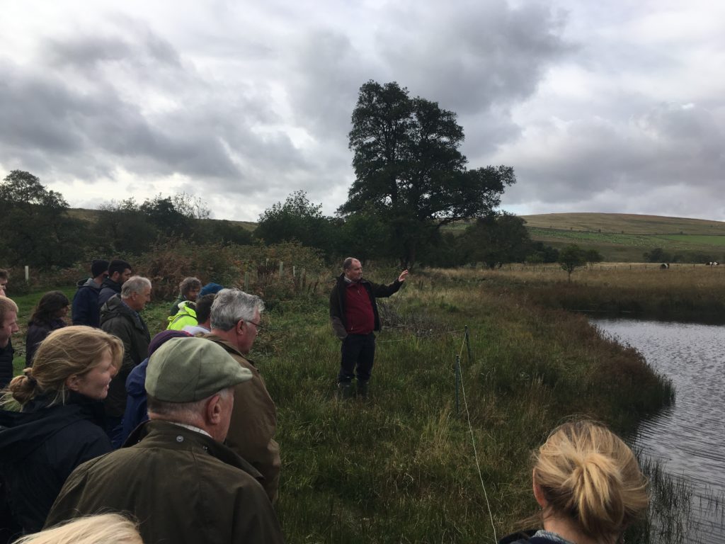
The group visited the completed river works at Yearhaugh and Dunn’s Houses, with thanks to the farmers who allowed us to access the land. We saw how a stream that had carried sediment and nutrients to the Rede has been worked into a series of ponds to form an ecologically-rich wetland. We then visited work to secure an eroding section of river bank, where high flood flows are now re-directed through a backwater channel, improving wetland habitat.
Our partners at The Environment Agency also took the opportunity to update farmers on how the Farming Rules for Water regulations may affect them and the new Fresh Water Pearl Mussel Specialist talked to farmers about their memories and local knowledge of mussels in the Rede.
Thank you to everyone who took part in the event, particularly the farmers who welcomed us onto their farms.
Your brief on what the team and partners have been getting up to
Bug hunts, artefacts, and reforging old connections
It has been a busy and thoroughly enjoyable summer for Revitalising Redesdale! First of all, thank you so much to all our volunteers and partners, without whom none of this would be possible. We started the season with a hugely successful Bioblitz at Otterburn Castle, with 69 people taking part in wildlife discovery sessions. From late July we led two archaeological excavations, at Rattenraw and Bellsheil. Although we knew Rattenraw is an interesting site, we were not quite prepared for what we found (Hint: the above picture)! Read the full story here. Whilst Bellsheil did not turn up anything quite as exciting, it was a brilliant opportunity to investigate the human history of the Otterburn Training Area and take part in archaeological training. Finally, river restoration work has started at Smoutel Ford to rebuild the historic bridleway across the Rede valley. Read the full story here.
Free archaeology training event: Level 1 Archaeological survey
Join us on an archaeological treasure hunt! This will be a training event for those wishing to learn about how to begin a survey of potential archaeological features, ranging from prehistoric to post-medieval.
Saturday, 21st September, 10am-4pm
Location: Chattlehope House, Catcleugh, NE19 1TY
To book contact Karen on 07741 194309 or email karen.collins@nnpa.org.uk
Archaeological survey and excavation at Fawdon Hill
Join us to help investigate possible burial mounds at Closehead Farm, Otterburn.
Wed, 25th September – detailed archaeological survey of features
Thur, 26th and Fri, 27th September – excavation of sample mounds
No previous experience necessary.
To book contact Karen on 07741 194309 or email karen.collins@nnpa.org.uk
Take part in Redesdale’s floral renaissance!
Wildflower planting
We have a number of wildflower planting days coming up to help increase the floral diversity of existing hay meadows in Redesdale. To get involved in this and other practical environmental volunteering, on a range of sites, and to help conserve and improve Redesdale (and other sites in Northumberland) for wildlife please register as a Northumberland Wildlife Trust Practical Conservation Volunteer. See the NWT website for more details.
Traditional skills and wildflowers
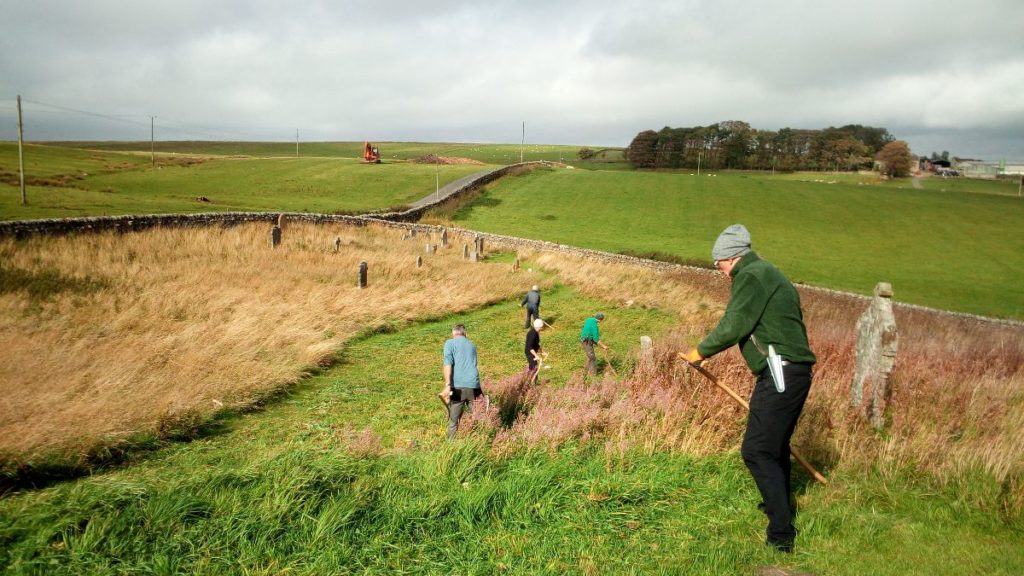
Keeping traditional skills alive in the community, volunteers with this project are using scythes to manage an area of St Cuthbert’s Churchyard, Corsenside as wildflower meadow. It’s only been managed like this for one season so far. We’re already starting to see results, but we need more people to get involved! Learn how to use a scythe and spend time in friendly company in a beautiful location.
If you or your group can spare a few days a year or would like to know more call Jennifer on: 0191 284 6884 or email Jennifer.Care@northwt.org.uk
Spiders on the Doorstep
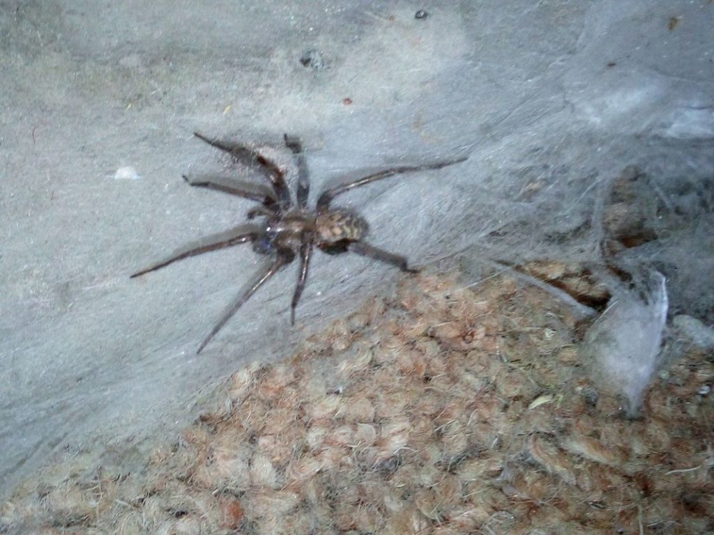
Do you have eight-legged visitors in and around your home? Learn about identification of common spiders, where to find them, and their fascinating behaviours.
13:30 to 15:30 – Saturday, 15th September
Corsenside Parish Hall, West Woodburn, NE48 2SQ
Booking and more details, here.
Battle of Otterburn – Volunteer Meeting

Join us for an update on our Battle of Otterburn project! Find out about our investigation into where and how the battle took place, and how you can help demystify this enigmatic event.
7:30pm – Thursday, 12th September
Otterburn Memorial Hall, Otterburn, NE19 1NP
If you planning to attend the meeting please let Karen know by email to Karen.Collins@nnpa.org.uk
Summer Shows
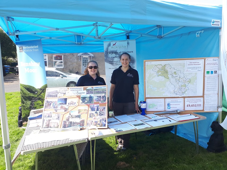
We had a great time talking to Redesdale locals and visitors at RedeFest and Elsdon Fete!
Find us at Corsenside Show (Sept 14th) and the Upper Redesdale Show (Sept 28th). We’d love to have a chat about what we are working on and how you could get involved.
Latest News & Events
Great Days Out in Redesdale
July 18, 2023
Explore Redesdale with four itineraries for a great day out – Revitalising Redesdale designed to help visitors to Redesdale plan their visit
Read more