News
News Archive
- ‘Amid the Hills of Redesdale’ community radio play released!
- A Fantastic Year for Redesdale!
- Archaeological Excavation report produced for Bellshiel
- Archaeological Excavation report produced for Yatesfield enclosed settlement
- Archaeological Survey Report Published For Ancient Settlement At Rattenraw
Redesdale Lidar Landscapes project report published
June 5, 2020
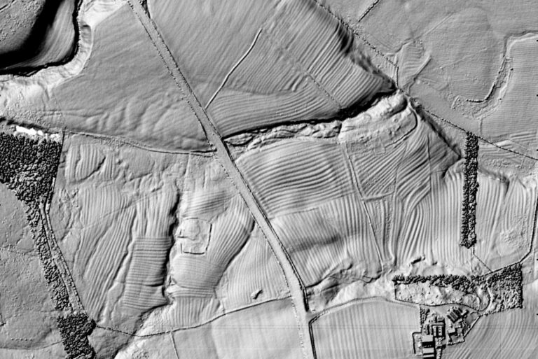
The Redesdale Lidar Landscapes project has involved volunteers undertaking archaeological landscape survey throughout Redesdale, using Lidar (‘light ranging and detecting’ or ‘light radar’) technology.
As part of the project, volunteers surveyed a whopping 333 square kilometres of Lidar data for Redesdale, recording a diverse range of sites, the majority of which were previously unrecorded. Following validation by the Project Consultant (Paul Frodsham of ORACLE Heritage Services), 1348 new records have been created as part of the project and will now be made publicly available through the Northumberland Historic Environment Record (HER) – visit the Keys to the Past website to take a look.
The Lidar survey has revealed a wealth of new detail for many known or suspected archaeological sites, as well as many entirely new sites, with 80% of all sites being previously unrecorded. Discoveries made by this project include:
- Several Bronze Age cairnfields, ranging in size from half a dozen to upwards of fifty cairns, some with associated field systems. Many of these were previously unrecorded or only partially recorded.
- Two previously unrecorded possible Bronze Age ring cairn or burial/funerary monuments, forming part of a large Bronze Age complex.
- A small number of previously unrecorded probable Iron Age ‘hillforts.’
- Numerous previously unrecorded Romano-British/Iron Age settlements.
- At least one probable unrecorded Roman marching camp and very significant new detail for other known camps.
- Extensive new evidence of medieval settlement and agriculture in Redesdale, including evidence of previously unrecorded or unlocated Deserted Medieval Villages.
- An extensive level of new detail on post-medieval agricultural and industrial landscapes.
You can read all about the project in our report below, which explains what we did and how as well as detailing some of the exciting things we found.
Leave a Reply